Tejamen geodata
Tejamen (Durango) is a populated place; located in Mexico in America/Monterrey (GMT-6) time zone. With population of 562 people, there are 15183 cities with bigger population in this country. Compared to other cities in Mexico, 91.5% of cities are located further ↓South; 92.1% of cities are located further →East and 77.2% of cities have lower elevation than Tejamen. Note1


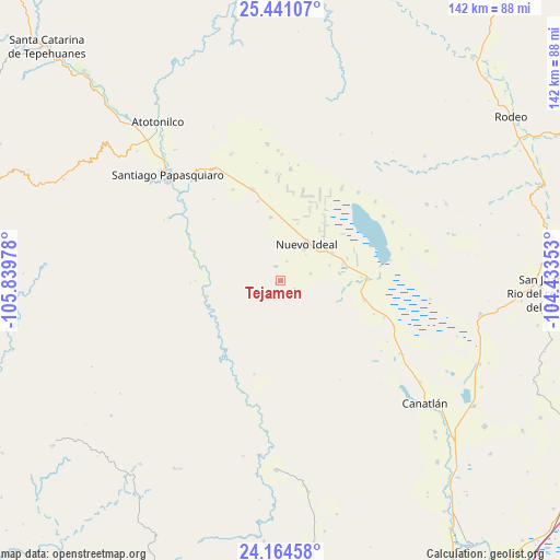
Tejamen GPS coordinates[2]
24° 48' 16.092" North, 105° 8' 11.94" West
| Map corner | latitude | longitude |
|---|---|---|
| Upper-left | 25.44107°, | -105.83978° |
| Center: | 24.80447°, | -105.13665° |
| Lower-right: | 24.16458°, | -104.43353° |
| Map W x H: | 141.9×141.9 km | = 88.2×88.2mi |
| max Lat: | 32.7° ⇑8.5% North |
| Tejamen: | 24.80447° |
| min Lat: | ⇓91.5% South 14.53588° |
| min Long | Tejamen | max Long |
| -117.105° | -105.13665° | -86.73105° |
| W 7.9%⇐ | ⇒92.1% E |
Elevation
Elevation of Tejamen is 2072 m = 6798 ft, and this is 818.3 m = 2685 ft above average elevation for this country.
| Max E: |
3497 m = 11473 ft | 22.8% |
| Tejamen | 2072 m 6798 ft | |
| Avg. | 1253.7 m = 4113 ft | |
Min E: |
-1 m = -3 ft | 77.2% |
See also: Mexico elevation on elevation.city.
Geographical zone
Tejamen is located in North temperate zone (between Tropic of Cancer and the Arctic Circle). Distance of this Northern Tropic circle is 152.1 km =94.5 mi to South.| Distance of | km | miles | from Tejamen |
|---|---|---|---|
| North Pole | 7249.1 | 4504.4 | to North |
| Arctic Circle | 4643.2 | 2885.1 | to North |
| Tropic Cancer | 152.1 | 94.5 | to South |
| Equator | 2758 | 1713.7 | to South |


Nearby cities:
15 places around Tejamen: (largest is in red/bold)
• Canatlán
48 km =29.8 mi,  130°
130°
• Coneto de Comonfort
41.8 km =26 mi,  62°
62°
• Doctor Castillo del Valle
29.8 km =18.5 mi,  41°
41°
• El Nuevo Porvenir
17.7 km =11 mi,  71°
71°
• El Progreso
35.4 km =22 mi,  121°
121°
• Esfuerzos Unidos
14.9 km =9.3 mi,  82°
82°
• Guatimapé
21.9 km =13.6 mi,  89°
89°
• José María Morelos
24.3 km =15.1 mi,  342°
342°
• La Sauceda
50.1 km =31.1 mi, 128°
• La Soledad
21.5 km =13.4 mi,  102°
102°
• Miguel Negrete
28.2 km =17.5 mi,  33°
33°
• Nogales
46.2 km =28.7 mi, 64°
• Nuevo Ideal
10.9 km =6.8 mi, 34°
• Santiago Papasquiaro
39 km =24.2 mi,  313°
313°
• Villa Hermosa
5.1 km =3.2 mi,  16°
16°
Sources, notices
• [Note1] Compared only with cities in Mexico existing in our database
• [Src1] Map data: © OpenStreetMap contributors (CC-BY-SA)
• [Src2] Other city data from geonames.org with taken over terms of usage.
• [Src3] Geographical zone / Annual Mean Temperature by Robert A. Rohde @ Wikipedia
