Zavala geodata
Zavala (Sinaloa) is a populated place; located in Mexico in America/Mazatlan (GMT-7) time zone. With population of 644 people, there are 13427 cities with bigger population in this country. Compared to other cities in Mexico, 88.7% of cities are located further ↓South; 93.8% of cities are located further →East and 80.3% of cities have higher elevation than Zavala. Note1


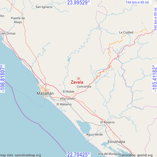
Zavala GPS coordinates[2]
23° 21' 4.824" North, 106° 6' 53.784" West
| Map corner | latitude | longitude |
|---|---|---|
| Upper-left | 23.99529°, | -106.81807° |
| Center: | 23.35134°, | -106.11494° |
| Lower-right: | 22.70425°, | -105.41182° |
| Map W x H: | 143.6×143.6 km | = 89.2×89.2mi |
| max Lat: | 32.7° ⇑11.3% North |
| Zavala: | 23.35134° |
| min Lat: | ⇓88.7% South 14.53588° |
| min Long | Zavala | max Long |
| -117.105° | -106.11494° | -86.73105° |
| W 6.2%⇐ | ⇒93.8% E |
Elevation
Elevation of Zavala is 91 m = 299 ft, and this is 1162.7 m = 3815 ft below average elevation for this country.
| Max E: |
3497 m = 11473 ft | 80.3% |
| Avg. | 1253.7 m = 4113 ft | |
| Zavala | 91 m = 299 ft | |
Min E: |
-1 m = -3 ft | 19.7% |
See also: Mexico elevation on elevation.city.
Geographical zone
Zavala is located in North Torrid zone (between Equator and Tropic of Cancer). Distance of this Northern Tropic circle is 9.5 km =5.9 mi to North.| Distance of | km | miles | from Zavala |
|---|---|---|---|
| North Pole | 7410.6 | 4604.7 | to North |
| Arctic Circle | 4804.7 | 2985.5 | to North |
| Tropic Cancer | 9.5 | 5.9 | to North |
| Equator | 2596.4 | 1613.3 | to South |


Nearby cities:
15 places around Zavala: (largest is in red/bold)
• Concordia
8.9 km =5.5 mi,  143°
143°
• Copala
19.1 km =11.9 mi,  75°
75°
• El Bajío
11.7 km =7.3 mi,  245°
245°
• El Recodo
11.7 km =7.3 mi,  301°
301°
• El Roble
15 km =9.3 mi,  218°
218°
• El Verde
2.5 km =1.6 mi,  305°
305°
• Escamillas
16.1 km =10 mi,  236°
236°
• La Concepción
7.3 km =4.5 mi, 311°
• Lomas de Monterrey
18 km =11.2 mi,  233°
233°
• Malpica
11 km =6.8 mi,  188°
188°
• Mesillas
13.5 km =8.4 mi,  149°
149°
• San Francisquito
18.6 km =11.6 mi, 229°
• Siqueros
12.9 km =8 mi,  265°
265°
• Tepuxta
11.1 km =6.9 mi, 308°
• Villa Unión
20.9 km =13 mi,  210°
210°
Sources, notices
• [Note1] Compared only with cities in Mexico existing in our database
• [Src1] Map data: © OpenStreetMap contributors (CC-BY-SA)
• [Src2] Other city data from geonames.org with taken over terms of usage.
• [Src3] Geographical zone / Annual Mean Temperature by Robert A. Rohde @ Wikipedia
