El Roble geodata
El Roble (Sinaloa) is a populated place; located in Mexico in America/Mazatlan (GMT-7) time zone. With population of 2,627 people, there are 3370 cities with bigger population in this country. Compared to other cities in Mexico, 88.5% of cities are located further ↓South; 93.9% of cities are located further →East and 87.5% of cities have higher elevation than El Roble. Note1


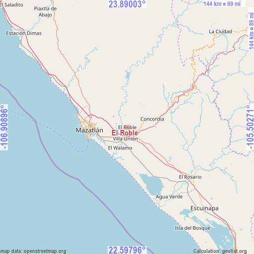
El Roble GPS coordinates[2]
23° 14' 44.016" North, 106° 12' 20.988" West
| Map corner | latitude | longitude |
|---|---|---|
| Upper-left | 23.89003°, | -106.90896° |
| Center: | 23.24556°, | -106.20583° |
| Lower-right: | 22.59796°, | -105.50271° |
| Map W x H: | 143.7×143.7 km | = 89.3×89.3mi |
| max Lat: | 32.7° ⇑11.5% North |
| El Roble: | 23.24556° |
| min Lat: | ⇓88.5% South 14.53588° |
| min Long | El Roble | max Long |
| -117.105° | -106.20583° | -86.73105° |
| W 6.1%⇐ | ⇒93.9% E |
Elevation
Elevation of El Roble is 32 m = 105 ft, and this is 1221.7 m = 4008 ft below average elevation for this country.
| Max E: |
3497 m = 11473 ft | 87.5% |
| Avg. | 1253.7 m = 4113 ft | |
| El Roble | 32 m = 105 ft | |
Min E: |
-1 m = -3 ft | 12.5% |
See also: Mexico elevation on elevation.city.
Geographical zone
El Roble is located in North Torrid zone (between Equator and Tropic of Cancer). Distance of this Northern Tropic circle is 21.3 km =13.2 mi to North.| Distance of | km | miles | from El Roble |
|---|---|---|---|
| North Pole | 7422.4 | 4612.1 | to North |
| Arctic Circle | 4816.5 | 2992.8 | to North |
| Tropic Cancer | 21.3 | 13.2 | to North |
| Equator | 2584.7 | 1606.1 | to South |


Nearby cities:
15 places around El Roble: (largest is in red/bold)
• Barrón
15.4 km =9.6 mi,  207°
207°
• Concordia
15.2 km =9.4 mi,  72°
72°
• El Bajío
7 km =4.3 mi,  349°
349°
• El Castillo
14.7 km =9.1 mi,  247°
247°
• El Vainillo
7.2 km =4.5 mi,  232°
232°
• El Verde
15.1 km =9.4 mi,  28°
28°
• El Walamo
12.4 km =7.7 mi,  198°
198°
• Escamillas
5.1 km =3.2 mi,  305°
305°
• Fraccionamiento los Ángeles
14.2 km =8.8 mi,  243°
243°
• Lomas de Monterrey
5.3 km =3.3 mi,  281°
281°
• Malpica
7.8 km =4.8 mi,  83°
83°
• San Francisquito
4.9 km =3 mi,  266°
266°
• Siqueros
11.3 km =7 mi,  341°
341°
• Villa Unión
6.3 km =3.9 mi,  192°
192°
• Zavala
15 km =9.3 mi,  38°
38°
Sources, notices
• [Note1] Compared only with cities in Mexico existing in our database
• [Src1] Map data: © OpenStreetMap contributors (CC-BY-SA)
• [Src2] Other city data from geonames.org with taken over terms of usage.
• [Src3] Geographical zone / Annual Mean Temperature by Robert A. Rohde @ Wikipedia
