Villachuato geodata
Villachuato (State of Mexico) is a populated place; located in Mexico in America/Mexico_City (GMT-6) time zone. With population of 3,986 people, there are 2286 cities with bigger population in this country. Compared to other cities in Mexico, 60.2% of cities are located further ↓South; 78.5% of cities are located further →East and 58.3% of cities have lower elevation than Villachuato. Note1


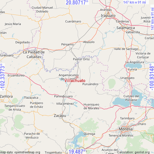
Villachuato GPS coordinates[2]
20° 8' 54.528" North, 101° 38' 4.56" West
| Map corner | latitude | longitude |
|---|---|---|
| Upper-left | 20.80717°, | -102.33773° |
| Center: | 20.14848°, | -101.6346° |
| Lower-right: | 19.487°, | -100.93148° |
| Map W x H: | 146.8×146.8 km | = 91.2×91.2mi |
| max Lat: | 32.7° ⇑39.8% North |
| Villachuato: | 20.14848° |
| min Lat: | ⇓60.2% South 14.53588° |
| min Long | Villachuato | max Long |
| -117.105° | -101.6346° | -86.73105° |
| W 21.5%⇐ | ⇒78.5% E |
Elevation
Elevation of Villachuato is 1695 m = 5561 ft, and this is 441.3 m = 1448 ft above average elevation for this country.
| Max E: |
3497 m = 11473 ft | 41.7% |
| Villachuato | 1695 m 5561 ft | |
| Avg. | 1253.7 m = 4113 ft | |
Min E: |
-1 m = -3 ft | 58.3% |
See also: Mexico elevation on elevation.city.
Geographical zone
Villachuato is located in North Torrid zone (between Equator and Tropic of Cancer). Distance of this Northern Tropic circle is 365.6 km =227.2 mi to North.| Distance of | km | miles | from Villachuato |
|---|---|---|---|
| North Pole | 7766.8 | 4826.1 | to North |
| Arctic Circle | 5160.9 | 3206.8 | to North |
| Tropic Cancer | 365.6 | 227.2 | to North |
| Equator | 2240.3 | 1392.1 | to South |


Nearby cities:
15 places around Villachuato: (largest is in red/bold)
• Angamacutiro de la Unión
8 km =5 mi,  271°
271°
• El Maluco
4.3 km =2.7 mi,  263°
263°
• Gildardo Magaña
9.7 km =6 mi,  351°
351°
• Héroes de la Revolución
8.2 km =5.1 mi,  295°
295°
• Janamuato
7.5 km =4.7 mi,  136°
136°
• La Estancia del Río
11.7 km =7.3 mi,  221°
221°
• Miravalle
6.5 km =4 mi, 263°
• Nuevo Progreso (Casas Viejas)
11.2 km =7 mi,  188°
188°
• Puerta de Agua Caliente
9.7 km =6 mi,  329°
329°
• Sabino Buenavista
9.3 km =5.8 mi,  148°
148°
• San José del Maluco
5.4 km =3.4 mi, 267°
• San Martín
7.9 km =4.9 mi,  17°
17°
• Santiago Conguripo
8.6 km =5.3 mi, 300°
• Ururuta
11.9 km =7.4 mi,  166°
166°
• Zapote de Parras
10.1 km =6.3 mi,  355°
355°
Sources, notices
• [Note1] Compared only with cities in Mexico existing in our database
• [Src1] Map data: © OpenStreetMap contributors (CC-BY-SA)
• [Src2] Other city data from geonames.org with taken over terms of usage.
• [Src3] Geographical zone / Annual Mean Temperature by Robert A. Rohde @ Wikipedia
