San Vicente de Jesús geodata
San Vicente de Jesús (Guerrero) is a populated place; located in Mexico in America/Mexico_City (GMT-6) time zone. With population of 512 people, there are 16417 cities with bigger population in this country. Compared to other cities in Mexico, 85.5% of cities are located further ↑North; 67.1% of cities are located further →East and 61.4% of cities have higher elevation than San Vicente de Jesús. Note1


San Vicente de Jesús GPS coordinates[2]
17° 16' 40.404" North, 100° 16' 14.448" West
| Map corner | latitude | longitude |
|---|---|---|
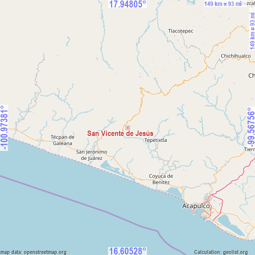
| Upper-left | 17.94805°, | -100.97381° |
| Center: | 17.27789°, | -100.27068° |
| Lower-right: | 16.60528°, | -99.56756° |
| Map W x H: | 149.3×149.3 km | = 92.8×92.8mi |
| max Lat: | 32.7° ⇑85.5% North |
| San Vicente de Jesús: | 17.27789° |
| min Lat: | ⇓14.5% South 14.53588° |
| min Long | San Vicente de | max Long |
| -117.105° | -100.27068° | -86.73105° |
| W 32.9%⇐ | ⇒67.1% E |
Elevation
Elevation of San Vicente de Jesús is 912 m = 2992 ft, and this is 341.7 m = 1121 ft below average elevation for this country.
| Max E: |
3497 m = 11473 ft | 61.4% |
| Avg. | 1253.7 m = 4113 ft | |
| San Vicente de Jesús | 912 m = 2992 ft | |
Min E: |
-1 m = -3 ft | 38.6% |
See also: Mexico elevation on elevation.city.
Geographical zone
San Vicente de Jesús is located in North Torrid zone (between Equator and Tropic of Cancer). Distance of this Northern Tropic circle is 684.8 km =425.5 mi to North.| Distance of | km | miles | from San Vicente de Jesús |
|---|---|---|---|
| North Pole | 8085.9 | 5024.3 | to North |
| Arctic Circle | 5480.1 | 3405.2 | to North |
| Tropic Cancer | 684.8 | 425.5 | to North |
| Equator | 1921.1 | 1193.7 | to South |


Nearby cities:
15 places around San Vicente de Jesús: (largest is in red/bold)
• Alcholoa
20.3 km =12.6 mi,  226°
226°
• Atoyac de Álvarez
19 km =11.8 mi,  245°
245°
• Cacalutla
19.1 km =11.9 mi,  206°
206°
• Colonia 2 de Diciembre de 1974
20.2 km =12.6 mi, 234°
• Colonia Buenos Aires
20.4 km =12.7 mi, 228°
• El Edén
18 km =11.2 mi,  51°
51°
• El Paraíso
8.6 km =5.3 mi,  31°
31°
• El Quemado
9.6 km =6 mi,  192°
192°
• El Ticui
19.7 km =12.2 mi, 249°
• La Pintada
13.2 km =8.2 mi,  55°
55°
• Río Santiago
5.6 km =3.5 mi,  241°
241°
• San Andrés de la Cruz
9.7 km =6 mi,  255°
255°
• San Juan de las Flores
14.1 km =8.8 mi,  287°
287°
• Santiago de la Unión
8.1 km =5 mi, 246°
• Tepetixtla
17.7 km =11 mi,  113°
113°
Sources, notices
• [Note1] Compared only with cities in Mexico existing in our database
• [Src1] Map data: © OpenStreetMap contributors (CC-BY-SA)
• [Src2] Other city data from geonames.org with taken over terms of usage.
• [Src3] Geographical zone / Annual Mean Temperature by Robert A. Rohde @ Wikipedia
