San Vicente el Chico geodata
San Vicente el Chico (Michoacán) is a populated place; located in Mexico in America/Mexico_City (GMT-6) time zone. With population of 551 people, there are 15478 cities with bigger population in this country. Compared to other cities in Mexico, 52.2% of cities are located further ↓South; 69.3% of cities are located further →East and 84.9% of cities have lower elevation than San Vicente el Chico. Note1
Current local time in San Vicente el Chico:
08:26 AM, WednesdayDifference from your time zone: hours


San Vicente el Chico GPS coordinates[2]
19° 46' 38.496" North, 100° 28' 51.6" West
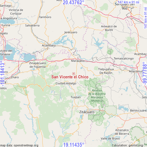
| Map corner | latitude | longitude |
|---|---|---|
| Upper-left | 20.43762°, | -101.18413° |
| Center: | 19.77736°, | -100.481° |
| Lower-right: | 19.11435°, | -99.77788° |
| Map W x H: | 147.1×147.1 km | = 91.4×91.4mi |
| max Lat: | 32.7° ⇑47.8% North |
| San Vicente el Chico: | 19.77736° |
| min Lat: | ⇓52.2% South 14.53588° |
| min Long | San Vicente el | max Long |
| -117.105° | -100.481° | -86.73105° |
| W 30.7%⇐ | ⇒69.3% E |
Elevation
Elevation of San Vicente el Chico is 2257 m = 7405 ft, and this is 1003.3 m = 3292 ft above average elevation for this country.
| Max E: |
3497 m = 11473 ft | 15.1% |
| San Vicente el Chico | 2257 m 7405 ft | |
| Avg. | 1253.7 m = 4113 ft | |
Min E: |
-1 m = -3 ft | 84.9% |
See also: Mexico elevation on elevation.city.
Geographical zone
San Vicente el Chico is located in North Torrid zone (between Equator and Tropic of Cancer). Distance of this Northern Tropic circle is 406.9 km =252.8 mi to North.| Distance of | km | miles | from San Vicente el Chico |
|---|---|---|---|
| North Pole | 7808 | 4851.7 | to North |
| Arctic Circle | 5202.1 | 3232.4 | to North |
| Tropic Cancer | 406.9 | 252.8 | to North |
| Equator | 2199 | 1366.4 | to South |


Nearby cities:
15 places around San Vicente el Chico: (largest is in red/bold)
• Aquiles Córdova Morán
9.7 km =6 mi,  216°
216°
• Campo Hermoso
10.8 km =6.7 mi,  47°
47°
• Casa Blanca
10.2 km =6.3 mi,  20°
20°
• Colonia Antorcha Campesina (Santa Rosa)
11.8 km =7.3 mi,  203°
203°
• Colonia Aquiles Córdoba Morán
9.7 km =6 mi, 215°
• Ejido de Pomas (Poblado de Dolores)
7.7 km =4.8 mi,  30°
30°
• Irimbo
8.5 km =5.3 mi,  178°
178°
• Las Palomas
11.4 km =7.1 mi,  299°
299°
• Los Sauces
11 km =6.8 mi,  103°
103°
• Magallanes (Los Pinos)
10.1 km =6.3 mi, 197°
• San Francisco Epunguio
9.7 km =6 mi,  152°
152°
• San José de Magallanes
10.2 km =6.3 mi,  192°
192°
• San Juan Huerta
7.9 km =4.9 mi,  76°
76°
• Santa Elena
11.8 km =7.3 mi,  40°
40°
• Tzintzingareo
1.6 km =1 mi, 196°
Sources, notices
• [Note1] Compared only with cities in Mexico existing in our database
• [Src1] Map data: © OpenStreetMap contributors (CC-BY-SA)
• [Src2] Other city data from geonames.org with taken over terms of usage.
• [Src3] Geographical zone / Annual Mean Temperature by Robert A. Rohde @ Wikipedia
