Las Palomas geodata
Las Palomas (Michoacán) is a populated place; located in Mexico in America/Mexico_City (GMT-6) time zone. With population of 508 people, there are 16554 cities with bigger population in this country. Compared to other cities in Mexico, 53.5% of cities are located further ↓South; 70.1% of cities are located further →East and 97.2% of cities have lower elevation than Las Palomas. Note1


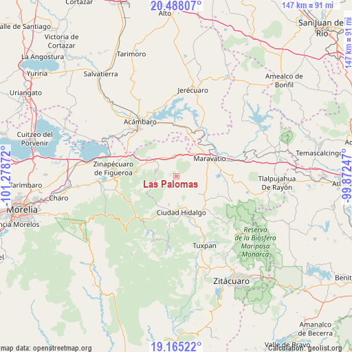
Las Palomas GPS coordinates[2]
19° 49' 40.872" North, 100° 34' 32.124" West
| Map corner | latitude | longitude |
|---|---|---|
| Upper-left | 20.48807°, | -101.27872° |
| Center: | 19.82802°, | -100.57559° |
| Lower-right: | 19.16522°, | -99.87247° |
| Map W x H: | 147.1×147.1 km | = 91.4×91.4mi |
| max Lat: | 32.7° ⇑46.5% North |
| Las Palomas: | 19.82802° |
| min Lat: | ⇓53.5% South 14.53588° |
| min Long | Las Palomas | max Long |
| -117.105° | -100.57559° | -86.73105° |
| W 29.9%⇐ | ⇒70.1% E |
Elevation
Elevation of Las Palomas is 2697 m = 8848 ft, and this is 1443.3 m = 4735 ft above average elevation for this country.
| Max E: |
3497 m = 11473 ft | 2.8% |
| Las Palomas | 2697 m 8848 ft | |
| Avg. | 1253.7 m = 4113 ft | |
Min E: |
-1 m = -3 ft | 97.2% |
See also: Mexico elevation on elevation.city.
Geographical zone
Las Palomas is located in North Torrid zone (between Equator and Tropic of Cancer). Distance of this Northern Tropic circle is 401.2 km =249.3 mi to North.| Distance of | km | miles | from Las Palomas |
|---|---|---|---|
| North Pole | 7802.4 | 4848.2 | to North |
| Arctic Circle | 5196.5 | 3229 | to North |
| Tropic Cancer | 401.2 | 249.3 | to North |
| Equator | 2204.7 | 1369.9 | to South |


Nearby cities:
15 places around Las Palomas: (largest is in red/bold)
• Aquiles Córdova Morán
14.1 km =8.8 mi,  162°
162°
• Barrio de San Miguel
13.1 km =8.1 mi,  15°
15°
• Buenavista
12.6 km =7.8 mi,  327°
327°
• Casa Blanca
14 km =8.7 mi,  73°
73°
• Colonia Aquiles Córdoba Morán
14.1 km =8.8 mi, 162°
• Ejido de Pomas (Poblado de Dolores)
13.9 km =8.6 mi,  85°
85°
• Heriberto Jara (La Presa)
9.7 km =6 mi,  343°
343°
• Huajúmbaro
5.5 km =3.4 mi, 327°
• Rincón de Rubios
12.2 km =7.6 mi,  208°
208°
• San Ildefonso
11.9 km =7.4 mi, 337°
• San Isidro Alta Huerta
13.3 km =8.3 mi, 209°
• San Vicente el Chico
11.4 km =7.1 mi,  119°
119°
• Santiago Puriatzícuaro
6.3 km =3.9 mi,  347°
347°
• Tzintzingareo
11.8 km =7.3 mi,  127°
127°
• Ucareo
14 km =8.7 mi,  304°
304°
Sources, notices
• [Note1] Compared only with cities in Mexico existing in our database
• [Src1] Map data: © OpenStreetMap contributors (CC-BY-SA)
• [Src2] Other city data from geonames.org with taken over terms of usage.
• [Src3] Geographical zone / Annual Mean Temperature by Robert A. Rohde @ Wikipedia
