San Tadeo geodata
San Tadeo (Aguascalientes) is a populated place; located in Mexico in America/Mexico_City (GMT-6) time zone. With population of 1,507 people, there are 5723 cities with bigger population in this country. Compared to other cities in Mexico, 83.6% of cities are located further ↓South; 84.8% of cities are located further →East and 58.7% of cities have lower elevation than San Tadeo. Note1


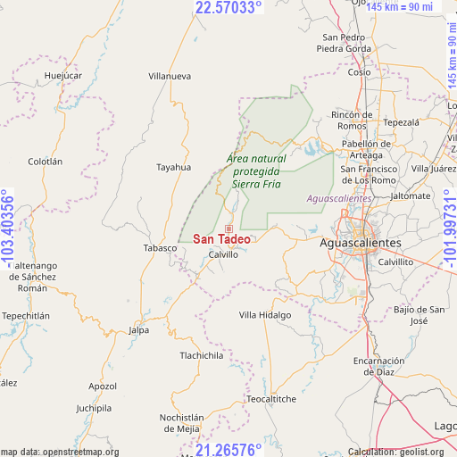
San Tadeo GPS coordinates[2]
21° 55' 10.344" North, 102° 42' 1.548" West
| Map corner | latitude | longitude |
|---|---|---|
| Upper-left | 22.57033°, | -103.40356° |
| Center: | 21.91954°, | -102.70043° |
| Lower-right: | 21.26576°, | -101.99731° |
| Map W x H: | 145.1×145.1 km | = 90.2×90.2mi |
| max Lat: | 32.7° ⇑16.4% North |
| San Tadeo: | 21.91954° |
| min Lat: | ⇓83.6% South 14.53588° |
| min Long | San Tadeo | max Long |
| -117.105° | -102.70043° | -86.73105° |
| W 15.2%⇐ | ⇒84.8% E |
Elevation
Elevation of San Tadeo is 1703 m = 5587 ft, and this is 449.3 m = 1474 ft above average elevation for this country.
| Max E: |
3497 m = 11473 ft | 41.3% |
| San Tadeo | 1703 m 5587 ft | |
| Avg. | 1253.7 m = 4113 ft | |
Min E: |
-1 m = -3 ft | 58.7% |
See also: Mexico elevation on elevation.city.
Geographical zone
San Tadeo is located in North Torrid zone (between Equator and Tropic of Cancer). Distance of this Northern Tropic circle is 168.7 km =104.8 mi to North.| Distance of | km | miles | from San Tadeo |
|---|---|---|---|
| North Pole | 7569.8 | 4703.7 | to North |
| Arctic Circle | 4963.9 | 3084.4 | to North |
| Tropic Cancer | 168.7 | 104.8 | to North |
| Equator | 2437.2 | 1514.4 | to South |


Nearby cities:
15 places around San Tadeo: (largest is in red/bold)
• Calvillo
8.4 km =5.2 mi,  192°
192°
• Crucero Las Pilas
12 km =7.5 mi,  211°
211°
• El Cuervero (Cuerveros)
6.8 km =4.2 mi,  165°
165°
• El Salitre
13.2 km =8.2 mi, 213°
• Jaltiche de Arriba
18.4 km =11.4 mi, 209°
• La Labor
4.7 km =2.9 mi,  5°
5°
• La Panadera
6.2 km =3.9 mi,  177°
177°
• La Rinconada
17.6 km =10.9 mi, 214°
• Malpaso
7.7 km =4.8 mi,  151°
151°
• Mesa Grande
12.9 km =8 mi, 189°
• Ojo de Agua
16.4 km =10.2 mi, 211°
• Ojocaliente
5.6 km =3.5 mi, 154°
• Solidaridad [Fraccionamiento]
3.6 km =2.2 mi, 189°
• Tapias Viejas
18.6 km =11.6 mi,  115°
115°
• Valle Huejúcar (Fraccionamiento Popular) [Fraccionamiento]
11.1 km =6.9 mi, 207°
Sources, notices
• [Note1] Compared only with cities in Mexico existing in our database
• [Src1] Map data: © OpenStreetMap contributors (CC-BY-SA)
• [Src2] Other city data from geonames.org with taken over terms of usage.
• [Src3] Geographical zone / Annual Mean Temperature by Robert A. Rohde @ Wikipedia
