San Miguel Xoltepec geodata
San Miguel Xoltepec (State of Mexico) is a populated place; located in Mexico in America/Mexico_City (GMT-6) time zone. With population of 1,417 people, there are 6099 cities with bigger population in this country. Compared to other cities in Mexico, 59.8% of cities are located further ↑North; 65% of cities are located further →East and 80.5% of cities have lower elevation than San Miguel Xoltepec. Note1


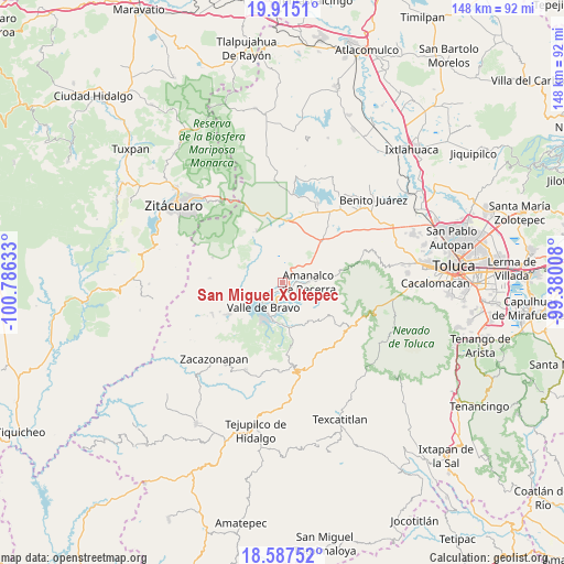
San Miguel Xoltepec GPS coordinates[2]
19° 15' 9.54" North, 100° 4' 59.52" West
| Map corner | latitude | longitude |
|---|---|---|
| Upper-left | 19.9151°, | -100.78633° |
| Center: | 19.25265°, | -100.0832° |
| Lower-right: | 18.58752°, | -99.38008° |
| Map W x H: | 147.6×147.6 km | = 91.7×91.7mi |
| max Lat: | 32.7° ⇑59.8% North |
| San Miguel Xoltepec: | 19.25265° |
| min Lat: | ⇓40.2% South 14.53588° |
| min Long | San Miguel Xolt | max Long |
| -117.105° | -100.0832° | -86.73105° |
| W 35%⇐ | ⇒65% E |
Elevation
Elevation of San Miguel Xoltepec is 2152 m = 7060 ft, and this is 898.3 m = 2947 ft above average elevation for this country.
| Max E: |
3497 m = 11473 ft | 19.5% |
| San Miguel Xoltepec | 2152 m 7060 ft | |
| Avg. | 1253.7 m = 4113 ft | |
Min E: |
-1 m = -3 ft | 80.5% |
See also: Mexico elevation on elevation.city.
Geographical zone
San Miguel Xoltepec is located in North Torrid zone (between Equator and Tropic of Cancer). Distance of this Northern Tropic circle is 465.2 km =289.1 mi to North.| Distance of | km | miles | from San Miguel Xoltepec |
|---|---|---|---|
| North Pole | 7866.4 | 4888 | to North |
| Arctic Circle | 5260.5 | 3268.7 | to North |
| Tropic Cancer | 465.2 | 289.1 | to North |
| Equator | 2140.7 | 1330.2 | to South |


Nearby cities:
15 places around San Miguel Xoltepec: (largest is in red/bold)
• Barrio de Guadalupe
6.2 km =3.9 mi,  214°
214°
• Colonia Rincón Villa del Valle
6.1 km =3.8 mi,  218°
218°
• El Arco
5.9 km =3.7 mi,  239°
239°
• Polvillos (San Bartolo Quinta Sección)
1.9 km =1.2 mi,  169°
169°
• San Antonio de la Laguna
5.5 km =3.4 mi,  12°
12°
• San Bartolo
3.3 km =2.1 mi,  105°
105°
• San Francisco Mihualtepec
1.8 km =1.1 mi, 241°
• San Gabriel Ixtla
4.3 km =2.7 mi,  277°
277°
• San Gaspar
6.3 km =3.9 mi, 244°
• San Jerónimo
6.5 km =4 mi,  99°
99°
• San Juan
5.6 km =3.5 mi, 96°
• San Miguel (San Miguel Tenextepec)
5.7 km =3.5 mi,  77°
77°
• San Sebastián el Grande
5.6 km =3.5 mi,  30°
30°
• San Simón de la Laguna
4.5 km =2.8 mi,  3°
3°
• Santa María Pipioltepec (Pipioltepec)
2 km =1.2 mi,  228°
228°
Sources, notices
• [Note1] Compared only with cities in Mexico existing in our database
• [Src1] Map data: © OpenStreetMap contributors (CC-BY-SA)
• [Src2] Other city data from geonames.org with taken over terms of usage.
• [Src3] Geographical zone / Annual Mean Temperature by Robert A. Rohde @ Wikipedia
