San Juan geodata
San Juan (State of Mexico) is a populated place; located in Mexico in America/Mexico_City (GMT-6) time zone. With population of 2,962 people, there are 3024 cities with bigger population in this country. Compared to other cities in Mexico, 60% of cities are located further ↑North; 64.4% of cities are located further →East and 87.8% of cities have lower elevation than San Juan. Note1


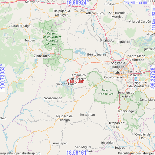
San Juan GPS coordinates[2]
19° 14' 48.372" North, 100° 1' 49.44" West
| Map corner | latitude | longitude |
|---|---|---|
| Upper-left | 19.90924°, | -100.73353° |
| Center: | 19.24677°, | -100.0304° |
| Lower-right: | 18.58161°, | -99.32728° |
| Map W x H: | 147.6×147.6 km | = 91.7×91.7mi |
| max Lat: | 32.7° ⇑60% North |
| San Juan: | 19.24677° |
| min Lat: | ⇓40% South 14.53588° |
| min Long | San Juan | max Long |
| -117.105° | -100.0304° | -86.73105° |
| W 35.6%⇐ | ⇒64.4% E |
Elevation
Elevation of San Juan is 2333 m = 7654 ft, and this is 1079.3 m = 3541 ft above average elevation for this country.
| Max E: |
3497 m = 11473 ft | 12.2% |
| San Juan | 2333 m 7654 ft | |
| Avg. | 1253.7 m = 4113 ft | |
Min E: |
-1 m = -3 ft | 87.8% |
See also: Mexico elevation on elevation.city.
Geographical zone
San Juan is located in North Torrid zone (between Equator and Tropic of Cancer). Distance of this Northern Tropic circle is 465.9 km =289.5 mi to North.| Distance of | km | miles | from San Juan |
|---|---|---|---|
| North Pole | 7867 | 4888.3 | to North |
| Arctic Circle | 5261.1 | 3269.1 | to North |
| Tropic Cancer | 465.9 | 289.5 | to North |
| Equator | 2140 | 1329.7 | to South |


Nearby cities:
15 places around San Juan: (largest is in red/bold)
• Amanalco de Becerra
1.4 km =0.9 mi,  55°
55°
• Polvillos (San Bartolo Quinta Sección)
5.3 km =3.3 mi,  257°
257°
• Pueblo Nuevo
4.9 km =3 mi,  3°
3°
• Rincón de Guadalupe
4.7 km =2.9 mi,  49°
49°
• San Bartolo
2.4 km =1.5 mi,  265°
265°
• San Francisco Mihualtepec
7.1 km =4.4 mi, 268°
• San Jerónimo
1 km =0.6 mi,  118°
118°
• San Lucas
2.8 km =1.7 mi, 59°
• San Mateo
4 km =2.5 mi,  23°
23°
• San Miguel (San Miguel Tenextepec)
1.9 km =1.2 mi, 1°
• San Miguel Xoltepec
5.6 km =3.5 mi,  276°
276°
• San Sebastián el Chico
2.5 km =1.6 mi, 22°
• San Sebastián el Grande
6.1 km =3.8 mi,  334°
334°
• San Simón de la Laguna
7.3 km =4.5 mi,  314°
314°
• Santa María Pipioltepec (Pipioltepec)
7.1 km =4.4 mi, 264°
Sources, notices
• [Note1] Compared only with cities in Mexico existing in our database
• [Src1] Map data: © OpenStreetMap contributors (CC-BY-SA)
• [Src2] Other city data from geonames.org with taken over terms of usage.
• [Src3] Geographical zone / Annual Mean Temperature by Robert A. Rohde @ Wikipedia
