San Bartolo geodata
San Bartolo (State of Mexico) is a populated place; located in Mexico in America/Mexico_City (GMT-6) time zone. With population of 2,360 people, there are 3744 cities with bigger population in this country. Compared to other cities in Mexico, 60% of cities are located further ↑North; 64.6% of cities are located further →East and 85.8% of cities have lower elevation than San Bartolo. Note1


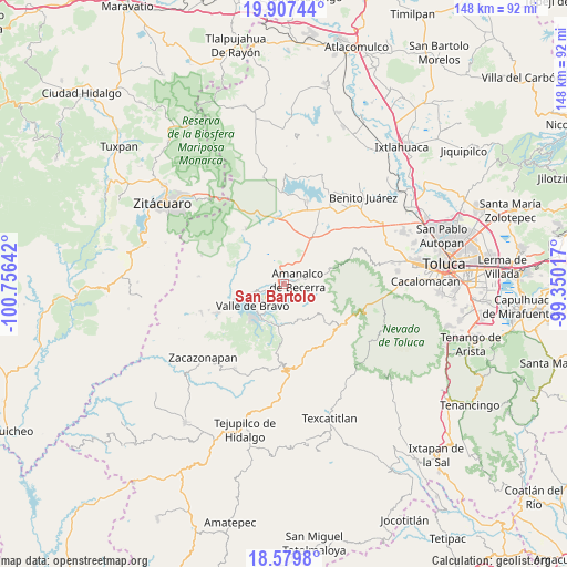
San Bartolo GPS coordinates[2]
19° 14' 41.856" North, 100° 3' 11.844" West
| Map corner | latitude | longitude |
|---|---|---|
| Upper-left | 19.90744°, | -100.75642° |
| Center: | 19.24496°, | -100.05329° |
| Lower-right: | 18.5798°, | -99.35017° |
| Map W x H: | 147.6×147.6 km | = 91.7×91.7mi |
| max Lat: | 32.7° ⇑60% North |
| San Bartolo: | 19.24496° |
| min Lat: | ⇓40% South 14.53588° |
| min Long | San Bartolo | max Long |
| -117.105° | -100.05329° | -86.73105° |
| W 35.4%⇐ | ⇒64.6% E |
Elevation
Elevation of San Bartolo is 2276 m = 7467 ft, and this is 1022.3 m = 3354 ft above average elevation for this country.
| Max E: |
3497 m = 11473 ft | 14.2% |
| San Bartolo | 2276 m 7467 ft | |
| Avg. | 1253.7 m = 4113 ft | |
Min E: |
-1 m = -3 ft | 85.8% |
See also: Mexico elevation on elevation.city.
Geographical zone
San Bartolo is located in North Torrid zone (between Equator and Tropic of Cancer). Distance of this Northern Tropic circle is 466.1 km =289.6 mi to North.| Distance of | km | miles | from San Bartolo |
|---|---|---|---|
| North Pole | 7867.2 | 4888.4 | to North |
| Arctic Circle | 5261.3 | 3269.2 | to North |
| Tropic Cancer | 466.1 | 289.6 | to North |
| Equator | 2139.8 | 1329.6 | to South |


Nearby cities:
15 places around San Bartolo: (largest is in red/bold)
• Amanalco de Becerra
3.6 km =2.2 mi,  74°
74°
• Polvillos (San Bartolo Quinta Sección)
3 km =1.9 mi,  250°
250°
• Pueblo Nuevo
5.8 km =3.6 mi,  28°
28°
• San Antonio de la Laguna
6.6 km =4.1 mi,  342°
342°
• San Francisco Mihualtepec
4.7 km =2.9 mi,  270°
270°
• San Jerónimo
3.3 km =2.1 mi,  94°
94°
• San Juan
2.4 km =1.5 mi, 85°
• San Lucas
5.1 km =3.2 mi, 71°
• San Mateo
5.6 km =3.5 mi,  46°
46°
• San Miguel (San Miguel Tenextepec)
3.2 km =2 mi, 49°
• San Miguel Xoltepec
3.3 km =2.1 mi,  285°
285°
• San Sebastián el Chico
4.2 km =2.6 mi, 53°
• San Sebastián el Grande
5.7 km =3.5 mi,  357°
357°
• San Simón de la Laguna
6 km =3.7 mi,  331°
331°
• Santa María Pipioltepec (Pipioltepec)
4.7 km =2.9 mi,  263°
263°
Sources, notices
• [Note1] Compared only with cities in Mexico existing in our database
• [Src1] Map data: © OpenStreetMap contributors (CC-BY-SA)
• [Src2] Other city data from geonames.org with taken over terms of usage.
• [Src3] Geographical zone / Annual Mean Temperature by Robert A. Rohde @ Wikipedia
