San Miguel (San Miguel Tenextepec) geodata
San Miguel (San Miguel Tenextepec) (State of Mexico) is a populated place; located in Mexico in America/Mexico_City (GMT-6) time zone. With population of 862 people, there are 10147 cities with bigger population in this country. Compared to other cities in Mexico, 59.6% of cities are located further ↑North; 64.4% of cities are located further →East and 87.7% of cities have lower elevation than San Miguel (San Miguel Tenextepec). Note1
Current local time in San Miguel (San Miguel Tenextepec):
09:00 AM, MondayDifference from your time zone: hours


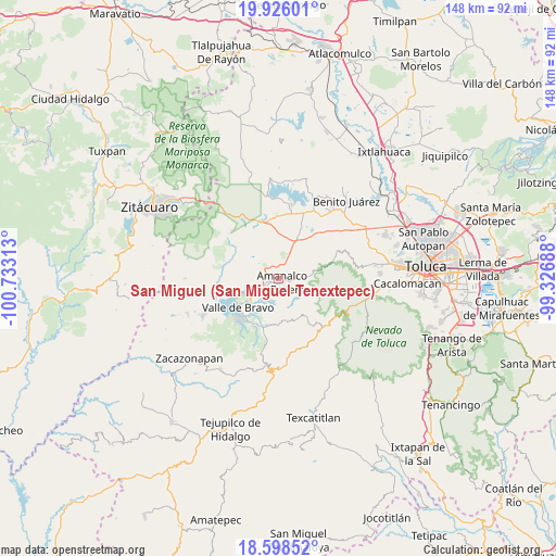
San Miguel (San Miguel Tenextepec) GPS coordinates[2]
19° 15' 48.996" North, 100° 1' 48" West
| Map corner | latitude | longitude |
|---|---|---|
| Upper-left | 19.92601°, | -100.73313° |
| Center: | 19.26361°, | -100.03° |
| Lower-right: | 18.59852°, | -99.32688° |
| Map W x H: | 147.6×147.6 km | = 91.7×91.7mi |
| max Lat: | 32.7° ⇑59.6% North |
| San Miguel (San Miguel Tenextepec): | 19.26361° |
| min Lat: | ⇓40.4% South 14.53588° |
| min Long | San Miguel (San | max Long |
| -117.105° | -100.03° | -86.73105° |
| W 35.6%⇐ | ⇒64.4% E |
Elevation
Elevation of San Miguel (San Miguel Tenextepec) is 2332 m = 7651 ft, and this is 1078.3 m = 3538 ft above average elevation for this country.
| Max E: |
3497 m = 11473 ft | 12.3% |
| San Miguel (San Miguel Tenextepec) | 2332 m 7651 ft | |
| Avg. | 1253.7 m = 4113 ft | |
Min E: |
-1 m = -3 ft | 87.7% |
See also: Mexico elevation on elevation.city.
Geographical zone
San Miguel (San Miguel Tenextepec) is located in North Torrid zone (between Equator and Tropic of Cancer). Distance of this Northern Tropic circle is 464 km =288.3 mi to North.| Distance of | km | miles | from San Miguel (San Miguel Tenextepec) |
|---|---|---|---|
| North Pole | 7865.1 | 4887.1 | to North |
| Arctic Circle | 5259.3 | 3268 | to North |
| Tropic Cancer | 464 | 288.3 | to North |
| Equator | 2141.9 | 1330.9 | to South |


Nearby cities:
15 places around San Miguel (San Miguel Tenextepec): (largest is in red/bold)
• Amanalco de Becerra
1.5 km =0.9 mi,  135°
135°
• Amanalco de Becerra
6.1 km =3.8 mi,  13°
13°
• El Potrero
6.1 km =3.8 mi,  38°
38°
• Polvillos (San Bartolo Quinta Sección)
6.1 km =3.8 mi,  239°
239°
• Pueblo Nuevo
3 km =1.9 mi, 5°
• Rincón de Guadalupe
3.7 km =2.3 mi,  71°
71°
• San Antonio de la Laguna
6.1 km =3.8 mi,  313°
313°
• San Bartolo
3.2 km =2 mi,  229°
229°
• San Jerónimo
2.5 km =1.6 mi,  160°
160°
• San Juan
1.9 km =1.2 mi,  181°
181°
• San Lucas
2.4 km =1.5 mi,  100°
100°
• San Mateo
2.4 km =1.5 mi, 41°
• San Miguel Xoltepec
5.7 km =3.5 mi,  257°
257°
• San Sebastián el Chico
1 km =0.6 mi,  64°
64°
• San Sebastián el Grande
4.6 km =2.9 mi,  323°
323°
Sources, notices
• [Note1] Compared only with cities in Mexico existing in our database
• [Src1] Map data: © OpenStreetMap contributors (CC-BY-SA)
• [Src2] Other city data from geonames.org with taken over terms of usage.
• [Src3] Geographical zone / Annual Mean Temperature by Robert A. Rohde @ Wikipedia
