San Lorenzo geodata
San Lorenzo (Guanajuato) is a populated place; located in Mexico in America/Mexico_City (GMT-6) time zone. With population of 1,173 people, there are 7403 cities with bigger population in this country. Compared to other cities in Mexico, 67% of cities are located further ↓South; 71.2% of cities are located further →East and 64.4% of cities have lower elevation than San Lorenzo. Note1


San Lorenzo GPS coordinates[2]
20° 28' 0.732" North, 100° 43' 10.92" West
| Map corner | latitude | longitude |
|---|---|---|
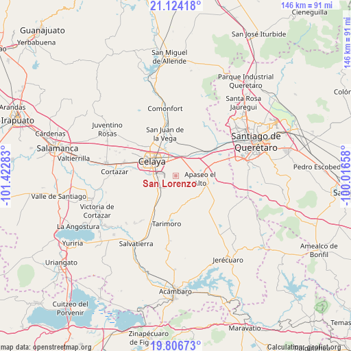
| Upper-left | 21.12418°, | -101.42283° |
| Center: | 20.46687°, | -100.7197° |
| Lower-right: | 19.80673°, | -100.01658° |
| Map W x H: | 146.5×146.5 km | = 91×91mi |
| max Lat: | 32.7° ⇑33% North |
| San Lorenzo: | 20.46687° |
| min Lat: | ⇓67% South 14.53588° |
| min Long | San Lorenzo | max Long |
| -117.105° | -100.7197° | -86.73105° |
| W 28.8%⇐ | ⇒71.2% E |
Elevation
Elevation of San Lorenzo is 1811 m = 5942 ft, and this is 557.3 m = 1828 ft above average elevation for this country.
| Max E: |
3497 m = 11473 ft | 35.6% |
| San Lorenzo | 1811 m 5942 ft | |
| Avg. | 1253.7 m = 4113 ft | |
Min E: |
-1 m = -3 ft | 64.4% |
See also: Mexico elevation on elevation.city.
Geographical zone
San Lorenzo is located in North Torrid zone (between Equator and Tropic of Cancer). Distance of this Northern Tropic circle is 330.2 km =205.2 mi to North.| Distance of | km | miles | from San Lorenzo |
|---|---|---|---|
| North Pole | 7731.4 | 4804.1 | to North |
| Arctic Circle | 5125.5 | 3184.8 | to North |
| Tropic Cancer | 330.2 | 205.2 | to North |
| Equator | 2275.7 | 1414.1 | to South |


Nearby cities:
15 places around San Lorenzo: (largest is in red/bold)
• Congregación de la Cruz
3.4 km =2.1 mi,  106°
106°
• Estancia del Llano
5 km =3.1 mi,  351°
351°
• Juan Martín
2.9 km =1.8 mi,  283°
283°
• La Cruz
8 km =5 mi,  262°
262°
• La Labor
7.7 km =4.8 mi,  13°
13°
• La Laja
8.2 km =5.1 mi,  327°
327°
• La Machuca
5.2 km =3.2 mi, 255°
• La Palma
5.9 km =3.7 mi,  22°
22°
• La Purísima
7.2 km =4.5 mi,  42°
42°
• Los Mancera
8.8 km =5.5 mi,  272°
272°
• Rancho Nuevo
7.4 km =4.6 mi,  340°
340°
• Rincón de Tamayo
6.1 km =3.8 mi,  217°
217°
• San José de Agua Azul
7 km =4.3 mi,  71°
71°
• San José el Nuevo
6 km =3.7 mi,  244°
244°
• Tenango el Nuevo
8.7 km =5.4 mi,  34°
34°
Sources, notices
• [Note1] Compared only with cities in Mexico existing in our database
• [Src1] Map data: © OpenStreetMap contributors (CC-BY-SA)
• [Src2] Other city data from geonames.org with taken over terms of usage.
• [Src3] Geographical zone / Annual Mean Temperature by Robert A. Rohde @ Wikipedia
