La Palma geodata
La Palma (Guanajuato) is a populated place; located in Mexico in America/Mexico_City (GMT-6) time zone. With population of 2,392 people, there are 3690 cities with bigger population in this country. Compared to other cities in Mexico, 68.1% of cities are located further ↓South; 71% of cities are located further →East and 63.4% of cities have lower elevation than La Palma. Note1


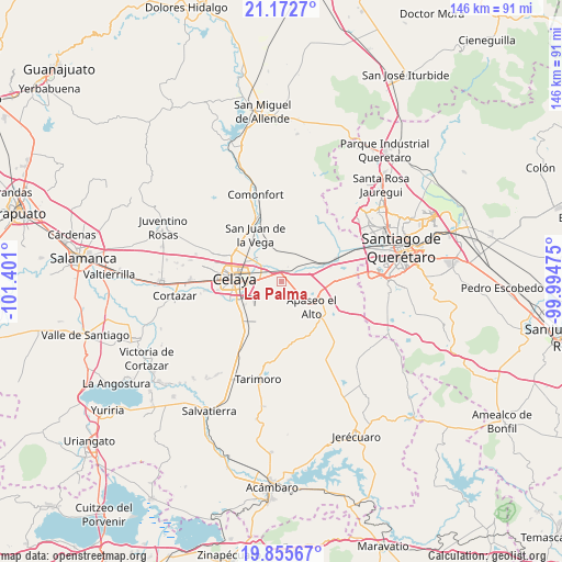
La Palma GPS coordinates[2]
20° 30' 56.16" North, 100° 41' 52.332" West
| Map corner | latitude | longitude |
|---|---|---|
| Upper-left | 21.1727°, | -101.401° |
| Center: | 20.5156°, | -100.69787° |
| Lower-right: | 19.85567°, | -99.99475° |
| Map W x H: | 146.4×146.4 km | = 91×91mi |
| max Lat: | 32.7° ⇑31.9% North |
| La Palma: | 20.5156° |
| min Lat: | ⇓68.1% South 14.53588° |
| min Long | La Palma | max Long |
| -117.105° | -100.69787° | -86.73105° |
| W 29%⇐ | ⇒71% E |
Elevation
Elevation of La Palma is 1786 m = 5860 ft, and this is 532.3 m = 1746 ft above average elevation for this country.
| Max E: |
3497 m = 11473 ft | 36.6% |
| La Palma | 1786 m 5860 ft | |
| Avg. | 1253.7 m = 4113 ft | |
Min E: |
-1 m = -3 ft | 63.4% |
See also: Mexico elevation on elevation.city.
Geographical zone
La Palma is located in North Torrid zone (between Equator and Tropic of Cancer). Distance of this Northern Tropic circle is 324.8 km =201.8 mi to North.| Distance of | km | miles | from La Palma |
|---|---|---|---|
| North Pole | 7725.9 | 4800.7 | to North |
| Arctic Circle | 5120.1 | 3181.5 | to North |
| Tropic Cancer | 324.8 | 201.8 | to North |
| Equator | 2281.1 | 1417.4 | to South |


Nearby cities:
15 places around La Palma: (largest is in red/bold)
• Apaseo el Grande
3.5 km =2.2 mi,  22°
22°
• Congregación de la Cruz
6.5 km =4 mi,  171°
171°
• Estancia del Llano
3 km =1.9 mi,  260°
260°
• Guadalupe del Monte
7.5 km =4.7 mi,  52°
52°
• Jocoqui
7.4 km =4.6 mi,  359°
359°
• Juan Martín
7 km =4.3 mi,  227°
227°
• La Labor
2.1 km =1.3 mi,  348°
348°
• La Laja
6.8 km =4.2 mi,  283°
283°
• La Purísima
2.6 km =1.6 mi,  92°
92°
• Rancho Nuevo
5 km =3.1 mi,  288°
288°
• San José de Agua Azul
5.4 km =3.4 mi,  126°
126°
• San Lorenzo
5.9 km =3.7 mi,  202°
202°
• San Pedro Tenango
6.9 km =4.3 mi,  97°
97°
• San Ramón
5.5 km =3.4 mi, 348°
• Tenango el Nuevo
3.2 km =2 mi,  57°
57°
Sources, notices
• [Note1] Compared only with cities in Mexico existing in our database
• [Src1] Map data: © OpenStreetMap contributors (CC-BY-SA)
• [Src2] Other city data from geonames.org with taken over terms of usage.
• [Src3] Geographical zone / Annual Mean Temperature by Robert A. Rohde @ Wikipedia
