San Juan Tecomatlán geodata
San Juan Tecomatlán (Jalisco) is a populated place; located in Mexico in America/Mexico_City (GMT-6) time zone. With population of 1,950 people, there are 4467 cities with bigger population in this country. Compared to other cities in Mexico, 64.1% of cities are located further ↓South; 86.1% of cities are located further →East and 52.5% of cities have lower elevation than San Juan Tecomatlán. Note1


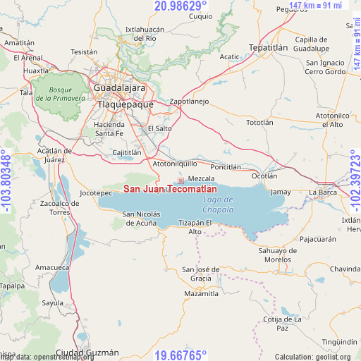
San Juan Tecomatlán GPS coordinates[2]
20° 19' 42.168" North, 103° 6' 1.26" West
| Map corner | latitude | longitude |
|---|---|---|
| Upper-left | 20.98629°, | -103.80348° |
| Center: | 20.32838°, | -103.10035° |
| Lower-right: | 19.66765°, | -102.39723° |
| Map W x H: | 146.6×146.6 km | = 91.1×91.1mi |
| max Lat: | 32.7° ⇑35.9% North |
| San Juan Tecomatlán: | 20.32838° |
| min Lat: | ⇓64.1% South 14.53588° |
| min Long | San Juan Tecoma | max Long |
| -117.105° | -103.10035° | -86.73105° |
| W 13.9%⇐ | ⇒86.1% E |
Elevation
Elevation of San Juan Tecomatlán is 1532 m = 5026 ft, and this is 278.3 m = 913 ft above average elevation for this country.
| Max E: |
3497 m = 11473 ft | 47.5% |
| San Juan Tecomatlán | 1532 m 5026 ft | |
| Avg. | 1253.7 m = 4113 ft | |
Min E: |
-1 m = -3 ft | 52.5% |
See also: Mexico elevation on elevation.city.
Geographical zone
San Juan Tecomatlán is located in North Torrid zone (between Equator and Tropic of Cancer). Distance of this Northern Tropic circle is 345.6 km =214.7 mi to North.| Distance of | km | miles | from San Juan Tecomatlán |
|---|---|---|---|
| North Pole | 7746.8 | 4813.6 | to North |
| Arctic Circle | 5140.9 | 3194.4 | to North |
| Tropic Cancer | 345.6 | 214.7 | to North |
| Equator | 2260.3 | 1404.5 | to South |


Nearby cities:
15 places around San Juan Tecomatlán: (largest is in red/bold)
• Atequiza
8 km =5 mi,  328°
328°
• Atotonilquillo
7.6 km =4.7 mi,  341°
341°
• Buenavista
13.5 km =8.4 mi,  296°
296°
• Chapala
10.1 km =6.3 mi,  249°
249°
• El Rodeo
12.2 km =7.6 mi,  317°
317°
• Ixtlahuacán de los Membrillos
10 km =6.2 mi,  283°
283°
• Los Freseros (Los Sabinos)
13.6 km =8.5 mi, 320°
• Mezcala
8.7 km =5.4 mi,  84°
84°
• San Jacinto
9 km =5.6 mi,  30°
30°
• San Miguel Zapotitlán
13.1 km =8.1 mi,  57°
57°
• San Nicolás de Ibarra
3 km =1.9 mi,  273°
273°
• San Pedro Itzicán
15.3 km =9.5 mi,  94°
94°
• Santa Cruz de la Soledad
6.2 km =3.9 mi,  258°
258°
• Tecualtitán
13.2 km =8.2 mi, 34°
• Valle de los Girasoles [Fraccionamiento]
15 km =9.3 mi, 316°
Sources, notices
• [Note1] Compared only with cities in Mexico existing in our database
• [Src1] Map data: © OpenStreetMap contributors (CC-BY-SA)
• [Src2] Other city data from geonames.org with taken over terms of usage.
• [Src3] Geographical zone / Annual Mean Temperature by Robert A. Rohde @ Wikipedia
