San José Itho geodata
San José Itho (Querétaro) is a populated place; located in Mexico in America/Mexico_City (GMT-6) time zone. With population of 1,587 people, there are 5439 cities with bigger population in this country. Compared to other cities in Mexico, 60.6% of cities are located further ↓South; 65.5% of cities are located further →East and 97.2% of cities have lower elevation than San José Itho. Note1


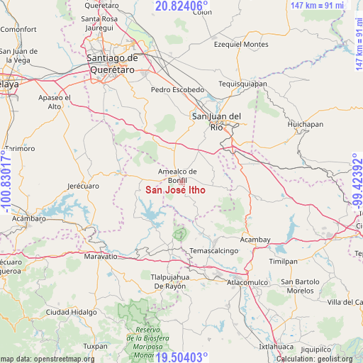
San José Itho GPS coordinates[2]
20° 9' 55.584" North, 100° 7' 37.344" West
| Map corner | latitude | longitude |
|---|---|---|
| Upper-left | 20.82406°, | -100.83017° |
| Center: | 20.16544°, | -100.12704° |
| Lower-right: | 19.50403°, | -99.42392° |
| Map W x H: | 146.8×146.8 km | = 91.2×91.2mi |
| max Lat: | 32.7° ⇑39.4% North |
| San José Itho: | 20.16544° |
| min Lat: | ⇓60.6% South 14.53588° |
| min Long | San José Itho | max Long |
| -117.105° | -100.12704° | -86.73105° |
| W 34.5%⇐ | ⇒65.5% E |
Elevation
Elevation of San José Itho is 2694 m = 8839 ft, and this is 1440.3 m = 4725 ft above average elevation for this country.
| Max E: |
3497 m = 11473 ft | 2.8% |
| San José Itho | 2694 m 8839 ft | |
| Avg. | 1253.7 m = 4113 ft | |
Min E: |
-1 m = -3 ft | 97.2% |
See also: Mexico elevation on elevation.city.
Geographical zone
San José Itho is located in North Torrid zone (between Equator and Tropic of Cancer). Distance of this Northern Tropic circle is 363.7 km =226 mi to North.| Distance of | km | miles | from San José Itho |
|---|---|---|---|
| North Pole | 7764.9 | 4824.9 | to North |
| Arctic Circle | 5159 | 3205.7 | to North |
| Tropic Cancer | 363.7 | 226 | to North |
| Equator | 2242.2 | 1393.2 | to South |


Nearby cities:
15 places around San José Itho: (largest is in red/bold)
• Amealco
3.1 km =1.9 mi,  322°
322°
• Chiteje de la Cruz
3.4 km =2.1 mi,  244°
244°
• Chitejé de Garabato
9.6 km =6 mi,  222°
222°
• El Lindero
7.3 km =4.5 mi,  184°
184°
• El Picacho
5.6 km =3.5 mi,  163°
163°
• El Varal
8.7 km =5.4 mi,  227°
227°
• Guadalupe el Terrero
5.6 km =3.5 mi,  202°
202°
• Hacienda Blanca
12.1 km =7.5 mi,  12°
12°
• La Ladera
7.6 km =4.7 mi,  117°
117°
• La Soledad
6.7 km =4.2 mi,  273°
273°
• Nuevo Amanecer
2.4 km =1.5 mi,  19°
19°
• San Bartolomé del Pino
5.8 km =3.6 mi,  72°
72°
• San Martín
10.7 km =6.6 mi,  338°
338°
• San Miguel Dehetí
5.6 km =3.5 mi, 12°
• San Nicolás de la Torre
10.1 km =6.3 mi, 164°
Sources, notices
• [Note1] Compared only with cities in Mexico existing in our database
• [Src1] Map data: © OpenStreetMap contributors (CC-BY-SA)
• [Src2] Other city data from geonames.org with taken over terms of usage.
• [Src3] Geographical zone / Annual Mean Temperature by Robert A. Rohde @ Wikipedia
