San Miguel Dehetí geodata
San Miguel Dehetí (Querétaro) is a populated place; located in Mexico in America/Mexico_City (GMT-6) time zone. With population of 1,000 people, there are 8715 cities with bigger population in this country. Compared to other cities in Mexico, 61.7% of cities are located further ↓South; 65.4% of cities are located further →East and 94.9% of cities have lower elevation than San Miguel Dehetí. Note1


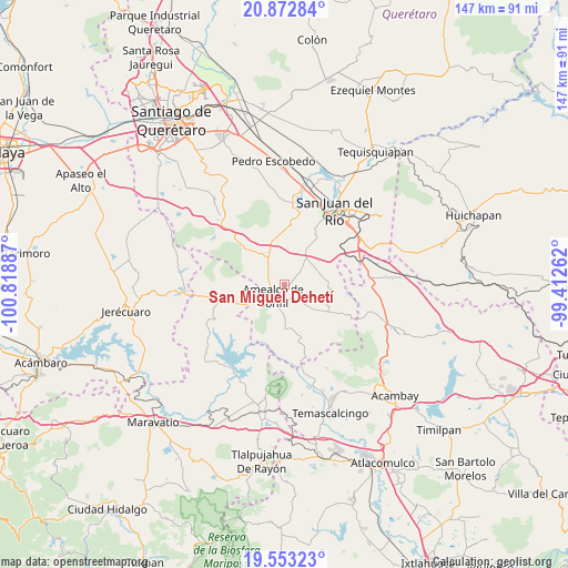
San Miguel Dehetí GPS coordinates[2]
20° 12' 51.948" North, 100° 6' 56.664" West
| Map corner | latitude | longitude |
|---|---|---|
| Upper-left | 20.87284°, | -100.81887° |
| Center: | 20.21443°, | -100.11574° |
| Lower-right: | 19.55323°, | -99.41262° |
| Map W x H: | 146.7×146.7 km | = 91.2×91.2mi |
| max Lat: | 32.7° ⇑38.3% North |
| San Miguel Dehetí: | 20.21443° |
| min Lat: | ⇓61.7% South 14.53588° |
| min Long | San Miguel Dehe | max Long |
| -117.105° | -100.11574° | -86.73105° |
| W 34.6%⇐ | ⇒65.4% E |
Elevation
Elevation of San Miguel Dehetí is 2594 m = 8510 ft, and this is 1340.3 m = 4397 ft above average elevation for this country.
| Max E: |
3497 m = 11473 ft | 5.1% |
| San Miguel Dehetí | 2594 m 8510 ft | |
| Avg. | 1253.7 m = 4113 ft | |
Min E: |
-1 m = -3 ft | 94.9% |
See also: Mexico elevation on elevation.city.
Geographical zone
San Miguel Dehetí is located in North Torrid zone (between Equator and Tropic of Cancer). Distance of this Northern Tropic circle is 358.3 km =222.6 mi to North.| Distance of | km | miles | from San Miguel Dehetí |
|---|---|---|---|
| North Pole | 7759.4 | 4821.5 | to North |
| Arctic Circle | 5153.5 | 3202.2 | to North |
| Tropic Cancer | 358.3 | 222.6 | to North |
| Equator | 2247.6 | 1396.6 | to South |


Nearby cities:
15 places around San Miguel Dehetí: (largest is in red/bold)
• Amealco
4.3 km =2.7 mi,  225°
225°
• Chiteje de la Cruz
8.1 km =5 mi,  211°
211°
• El Lindero
12.8 km =8 mi,  187°
187°
• El Picacho
10.8 km =6.7 mi,  177°
177°
• El Rincón
10.8 km =6.7 mi,  299°
299°
• Guadalupe el Terrero
11.1 km =6.9 mi,  197°
197°
• Hacienda Blanca
6.5 km =4 mi,  13°
13°
• La Ladera
10.6 km =6.6 mi,  148°
148°
• La Soledad
9.3 km =5.8 mi,  237°
237°
• Nuevo Amanecer
3.2 km =2 mi, 186°
• San Bartolomé del Pino
5.7 km =3.5 mi,  130°
130°
• San José Itho
5.6 km =3.5 mi, 192°
• San Martín
6.8 km =4.2 mi,  311°
311°
• San Pablo Potrerillos
11.3 km =7 mi,  20°
20°
• Santa Lucía
12.8 km =8 mi,  28°
28°
Sources, notices
• [Note1] Compared only with cities in Mexico existing in our database
• [Src1] Map data: © OpenStreetMap contributors (CC-BY-SA)
• [Src2] Other city data from geonames.org with taken over terms of usage.
• [Src3] Geographical zone / Annual Mean Temperature by Robert A. Rohde @ Wikipedia
