La Ladera geodata
La Ladera (Querétaro) is a populated place; located in Mexico in America/Mexico_City (GMT-6) time zone. With population of 528 people, there are 16014 cities with bigger population in this country. Compared to other cities in Mexico, 59.8% of cities are located further ↓South; 64.7% of cities are located further →East and 92.8% of cities have lower elevation than La Ladera. Note1


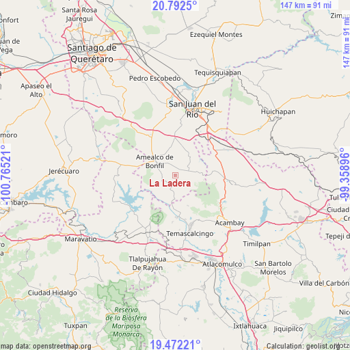
La Ladera GPS coordinates[2]
20° 8' 1.5" North, 100° 3' 43.488" West
| Map corner | latitude | longitude |
|---|---|---|
| Upper-left | 20.7925°, | -100.76521° |
| Center: | 20.13375°, | -100.06208° |
| Lower-right: | 19.47221°, | -99.35896° |
| Map W x H: | 146.8×146.8 km | = 91.2×91.2mi |
| max Lat: | 32.7° ⇑40.2% North |
| La Ladera: | 20.13375° |
| min Lat: | ⇓59.8% South 14.53588° |
| min Long | La Ladera | max Long |
| -117.105° | -100.06208° | -86.73105° |
| W 35.3%⇐ | ⇒64.7% E |
Elevation
Elevation of La Ladera is 2518 m = 8261 ft, and this is 1264.3 m = 4148 ft above average elevation for this country.
| Max E: |
3497 m = 11473 ft | 7.2% |
| La Ladera | 2518 m 8261 ft | |
| Avg. | 1253.7 m = 4113 ft | |
Min E: |
-1 m = -3 ft | 92.8% |
See also: Mexico elevation on elevation.city.
Geographical zone
La Ladera is located in North Torrid zone (between Equator and Tropic of Cancer). Distance of this Northern Tropic circle is 367.3 km =228.2 mi to North.| Distance of | km | miles | from La Ladera |
|---|---|---|---|
| North Pole | 7768.4 | 4827.1 | to North |
| Arctic Circle | 5162.5 | 3207.8 | to North |
| Tropic Cancer | 367.3 | 228.2 | to North |
| Equator | 2238.7 | 1391.1 | to South |


Nearby cities:
15 places around La Ladera: (largest is in red/bold)
• Amealco
10.5 km =6.5 mi,  304°
304°
• Chiteje de la Cruz
10.1 km =6.3 mi,  281°
281°
• Donicá
10.5 km =6.5 mi,  185°
185°
• El Lindero
8.3 km =5.2 mi,  243°
243°
• El Picacho
5.5 km =3.4 mi,  250°
250°
• Guadalupe el Terrero
9.1 km =5.7 mi,  259°
259°
• Mesillas
6.3 km =3.9 mi,  87°
87°
• Nuevo Amanecer
8.3 km =5.2 mi,  314°
314°
• San Bartolomé del Pino
5.4 km =3.4 mi,  346°
346°
• San Francisco Shaxni Ejido
9.8 km =6.1 mi,  134°
134°
• San José Itho
7.6 km =4.7 mi, 297°
• San Nicolás de la Torre
7.4 km =4.6 mi,  213°
213°
• San Pablo
10.1 km =6.3 mi,  119°
119°
• Santiago Mexquititlán Barrio 4to.
7.9 km =4.9 mi,  184°
184°
• Tenasdá (Barrio de San Ildefonso)
10.1 km =6.3 mi,  102°
102°
Sources, notices
• [Note1] Compared only with cities in Mexico existing in our database
• [Src1] Map data: © OpenStreetMap contributors (CC-BY-SA)
• [Src2] Other city data from geonames.org with taken over terms of usage.
• [Src3] Geographical zone / Annual Mean Temperature by Robert A. Rohde @ Wikipedia
