San Jose Solís geodata
San Jose Solís (Morelos) is a populated place; located in Mexico in America/Mexico_City (GMT-6) time zone. With population of 1,197 people, there are 7253 cities with bigger population in this country. Compared to other cities in Mexico, 57% of cities are located further ↓South; 64.6% of cities are located further →East and 89.5% of cities have lower elevation than San Jose Solís. Note1


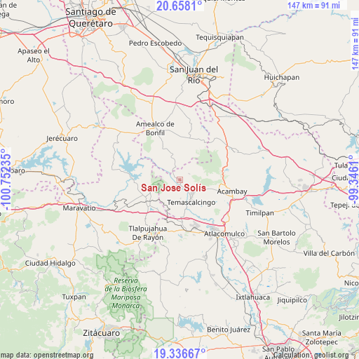
San Jose Solís GPS coordinates[2]
19° 59' 55.572" North, 100° 2' 57.192" West
| Map corner | latitude | longitude |
|---|---|---|
| Upper-left | 20.6581°, | -100.75235° |
| Center: | 19.99877°, | -100.04922° |
| Lower-right: | 19.33667°, | -99.3461° |
| Map W x H: | 146.9×146.9 km | = 91.3×91.3mi |
| max Lat: | 32.7° ⇑43% North |
| San Jose Solís: | 19.99877° |
| min Lat: | ⇓57% South 14.53588° |
| min Long | San Jose Solís | max Long |
| -117.105° | -100.04922° | -86.73105° |
| W 35.4%⇐ | ⇒64.6% E |
Elevation
Elevation of San Jose Solís is 2387 m = 7831 ft, and this is 1133.3 m = 3718 ft above average elevation for this country.
| Max E: |
3497 m = 11473 ft | 10.5% |
| San Jose Solís | 2387 m 7831 ft | |
| Avg. | 1253.7 m = 4113 ft | |
Min E: |
-1 m = -3 ft | 89.5% |
See also: Mexico elevation on elevation.city.
Geographical zone
San Jose Solís is located in North Torrid zone (between Equator and Tropic of Cancer). Distance of this Northern Tropic circle is 382.3 km =237.6 mi to North.| Distance of | km | miles | from San Jose Solís |
|---|---|---|---|
| North Pole | 7783.4 | 4836.4 | to North |
| Arctic Circle | 5177.5 | 3217.1 | to North |
| Tropic Cancer | 382.3 | 237.6 | to North |
| Equator | 2223.7 | 1381.7 | to South |


Nearby cities:
15 places around San Jose Solís: (largest is in red/bold)
• Agostadero (San José Agostadero)
6.8 km =4.2 mi,  46°
46°
• Ahuacatitlan Centro
7.9 km =4.9 mi,  128°
128°
• Ahuacatitlán Cuarto y Quinto Cuartel
7.7 km =4.8 mi,  121°
121°
• Calderas
3.8 km =2.4 mi,  108°
108°
• Cerritos de Cárdenas
4.3 km =2.7 mi,  139°
139°
• Donicá
5.1 km =3.2 mi,  332°
332°
• El Rodeo
6.9 km =4.3 mi,  204°
204°
• Juando
6.3 km =3.9 mi,  55°
55°
• La Loma
4.7 km =2.9 mi, 60°
• La Magdalena
7.7 km =4.8 mi, 137°
• Puentecillas
8 km =5 mi,  68°
68°
• San Antonio Solís
3.9 km =2.4 mi,  271°
271°
• San Francisco Solis
7.7 km =4.8 mi,  176°
176°
• San Nicolás Solís
2.6 km =1.6 mi, 109°
• Santiago Mexquititlán Barrio 4to.
7.4 km =4.6 mi,  344°
344°
Sources, notices
• [Note1] Compared only with cities in Mexico existing in our database
• [Src1] Map data: © OpenStreetMap contributors (CC-BY-SA)
• [Src2] Other city data from geonames.org with taken over terms of usage.
• [Src3] Geographical zone / Annual Mean Temperature by Robert A. Rohde @ Wikipedia
