Juando geodata
Juando (Morelos) is a populated place; located in Mexico in America/Mexico_City (GMT-6) time zone. With population of 726 people, there are 12023 cities with bigger population in this country. Compared to other cities in Mexico, 57.6% of cities are located further ↓South; 64% of cities are located further →East and 97.2% of cities have lower elevation than Juando. Note1


Juando GPS coordinates[2]
20° 1' 49.8" North, 99° 59' 58.56" West
| Map corner | latitude | longitude |
|---|---|---|
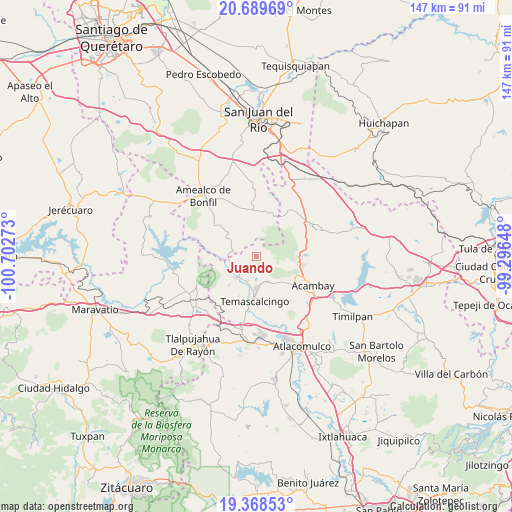
| Upper-left | 20.68969°, | -100.70273° |
| Center: | 20.0305°, | -99.9996° |
| Lower-right: | 19.36853°, | -99.29648° |
| Map W x H: | 146.9×146.9 km | = 91.3×91.3mi |
| max Lat: | 32.7° ⇑42.4% North |
| Juando: | 20.0305° |
| min Lat: | ⇓57.6% South 14.53588° |
| min Long | Juando | max Long |
| -117.105° | -99.9996° | -86.73105° |
| W 36%⇐ | ⇒64% E |
Elevation
Elevation of Juando is 2692 m = 8832 ft, and this is 1438.3 m = 4719 ft above average elevation for this country.
| Max E: |
3497 m = 11473 ft | 2.8% |
| Juando | 2692 m 8832 ft | |
| Avg. | 1253.7 m = 4113 ft | |
Min E: |
-1 m = -3 ft | 97.2% |
See also: Mexico elevation on elevation.city.
Geographical zone
Juando is located in North Torrid zone (between Equator and Tropic of Cancer). Distance of this Northern Tropic circle is 378.7 km =235.3 mi to North.| Distance of | km | miles | from Juando |
|---|---|---|---|
| North Pole | 7779.9 | 4834.2 | to North |
| Arctic Circle | 5174 | 3215 | to North |
| Tropic Cancer | 378.7 | 235.3 | to North |
| Equator | 2227.2 | 1383.9 | to South |


Nearby cities:
15 places around Juando: (largest is in red/bold)
• Agostadero (San José Agostadero)
1.1 km =0.7 mi,  347°
347°
• Ahuacatitlán Cuarto y Quinto Cuartel
7.7 km =4.8 mi,  170°
170°
• Calderas
5 km =3.1 mi,  197°
197°
• Cerritos de Cárdenas
7.2 km =4.5 mi, 199°
• Conejeras
4.4 km =2.7 mi,  116°
116°
• Donicá
7.6 km =4.7 mi,  277°
277°
• Doxteje Centro
7.7 km =4.8 mi,  142°
142°
• Doxtejé Centro
8.3 km =5.2 mi, 144°
• La Loma
1.6 km =1 mi,  222°
222°
• Puentecillas
2.3 km =1.4 mi,  103°
103°
• San Francisco Shaxni Ejido
4.6 km =2.9 mi,  5°
5°
• San Jose Solís
6.3 km =3.9 mi,  235°
235°
• San Nicolás Solís
5.2 km =3.2 mi,  212°
212°
• San Pablo
6.8 km =4.2 mi,  19°
19°
• Santiago Mexquititlán Barrio 4to.
8 km =5 mi,  296°
296°
Sources, notices
• [Note1] Compared only with cities in Mexico existing in our database
• [Src1] Map data: © OpenStreetMap contributors (CC-BY-SA)
• [Src2] Other city data from geonames.org with taken over terms of usage.
• [Src3] Geographical zone / Annual Mean Temperature by Robert A. Rohde @ Wikipedia
