San Joaquín Zorrillos geodata
San Joaquín Zorrillos (Jalisco) is a populated place; located in Mexico in America/Mexico_City (GMT-6) time zone. With population of 1,020 people, there are 8532 cities with bigger population in this country. Compared to other cities in Mexico, 70.4% of cities are located further ↓South; 85.8% of cities are located further →East and 57.5% of cities have lower elevation than San Joaquín Zorrillos. Note1


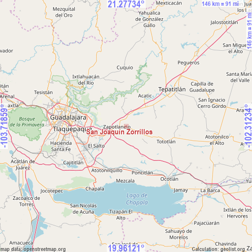
San Joaquín Zorrillos GPS coordinates[2]
20° 37' 14.52" North, 103° 0' 55.656" West
| Map corner | latitude | longitude |
|---|---|---|
| Upper-left | 21.27734°, | -103.71859° |
| Center: | 20.6207°, | -103.01546° |
| Lower-right: | 19.96121°, | -102.31234° |
| Map W x H: | 146.3×146.3 km | = 90.9×90.9mi |
| max Lat: | 32.7° ⇑29.6% North |
| San Joaquín Zorrillos: | 20.6207° |
| min Lat: | ⇓70.4% South 14.53588° |
| min Long | San Joaquín Zo | max Long |
| -117.105° | -103.01546° | -86.73105° |
| W 14.2%⇐ | ⇒85.8% E |
Elevation
Elevation of San Joaquín Zorrillos is 1677 m = 5502 ft, and this is 423.3 m = 1389 ft above average elevation for this country.
| Max E: |
3497 m = 11473 ft | 42.5% |
| San Joaquín Zorrillos | 1677 m 5502 ft | |
| Avg. | 1253.7 m = 4113 ft | |
Min E: |
-1 m = -3 ft | 57.5% |
See also: Mexico elevation on elevation.city.
Geographical zone
San Joaquín Zorrillos is located in North Torrid zone (between Equator and Tropic of Cancer). Distance of this Northern Tropic circle is 313.1 km =194.6 mi to North.| Distance of | km | miles | from San Joaquín Zorrillos |
|---|---|---|---|
| North Pole | 7714.3 | 4793.4 | to North |
| Arctic Circle | 5108.4 | 3174.2 | to North |
| Tropic Cancer | 313.1 | 194.6 | to North |
| Equator | 2292.8 | 1424.7 | to South |


Nearby cities:
15 places around San Joaquín Zorrillos: (largest is in red/bold)
• Agua Escondida
14.1 km =8.8 mi,  210°
210°
• Cerro Santa Fe
12.7 km =7.9 mi, 214°
• El Salitre
11.7 km =7.3 mi,  229°
229°
• El Vado
14.7 km =9.1 mi,  264°
264°
• La Laja
12 km =7.5 mi,  247°
247°
• La Loma
11.3 km =7 mi, 245°
• La Mezquitera
12.3 km =7.6 mi,  235°
235°
• La Paz
9.7 km =6 mi,  203°
203°
• La Purísima
9.2 km =5.7 mi,  348°
348°
• Mismaloya (Fraccionamiento Pedregal de Santa Martha)
16.3 km =10.1 mi, 264°
• Pueblos de la Barranca (El Maestranzo)
13.2 km =8.2 mi, 252°
• Puente Grande
15.5 km =9.6 mi, 248°
• San José de las Flores
6 km =3.7 mi,  58°
58°
• Tecomatlán
11 km =6.8 mi,  92°
92°
• Zapotlanejo
5.4 km =3.4 mi,  272°
272°
Sources, notices
• [Note1] Compared only with cities in Mexico existing in our database
• [Src1] Map data: © OpenStreetMap contributors (CC-BY-SA)
• [Src2] Other city data from geonames.org with taken over terms of usage.
• [Src3] Geographical zone / Annual Mean Temperature by Robert A. Rohde @ Wikipedia
