San Guillermo geodata
San Guillermo (Chihuahua) is a populated place; located in Mexico in America/Chihuahua (GMT-6) time zone. With population of 979 people, there are 8884 cities with bigger population in this country. Compared to other cities in Mexico, 97.8% of cities are located further ↓South; 93.7% of cities are located further →East and 53% of cities have lower elevation than San Guillermo. Note1


San Guillermo GPS coordinates[2]
28° 35' 15.108" North, 105° 55' 53.94" West
| Map corner | latitude | longitude |
|---|---|---|
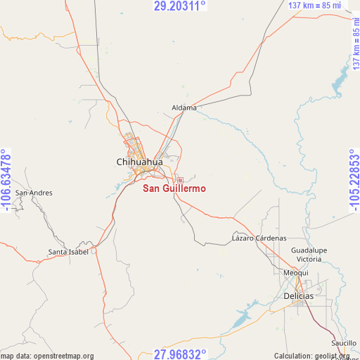
| Upper-left | 29.20311°, | -106.63478° |
| Center: | 28.58753°, | -105.93165° |
| Lower-right: | 27.96832°, | -105.22853° |
| Map W x H: | 137.3×137.3 km | = 85.3×85.3mi |
| max Lat: | 32.7° ⇑2.2% North |
| San Guillermo: | 28.58753° |
| min Lat: | ⇓97.8% South 14.53588° |
| min Long | San Guillermo | max Long |
| -117.105° | -105.93165° | -86.73105° |
| W 6.3%⇐ | ⇒93.7% E |
Elevation
Elevation of San Guillermo is 1541 m = 5056 ft, and this is 287.3 m = 943 ft above average elevation for this country.
| Max E: |
3497 m = 11473 ft | 47% |
| San Guillermo | 1541 m 5056 ft | |
| Avg. | 1253.7 m = 4113 ft | |
Min E: |
-1 m = -3 ft | 53% |
See also: Mexico elevation on elevation.city.
Geographical zone
San Guillermo is located in North temperate zone (between Tropic of Cancer and the Arctic Circle). Distance of this Northern Tropic circle is 572.7 km =355.9 mi to South.| Distance of | km | miles | from San Guillermo |
|---|---|---|---|
| North Pole | 6828.4 | 4243 | to North |
| Arctic Circle | 4222.5 | 2623.7 | to North |
| Tropic Cancer | 572.7 | 355.9 | to South |
| Equator | 3178.6 | 1975.1 | to South |


Nearby cities:
15 places around San Guillermo: (largest is in red/bold)
• Aldama
27.8 km =17.3 mi,  3°
3°
• Ampliación Colonia Lázaro Cárdenas
38.3 km =23.8 mi,  126°
126°
• Barranco Blanco
35.4 km =22 mi,  117°
117°
• Chihuahua
16.2 km =10.1 mi,  289°
289°
• Colonia Esperanza
49.2 km =30.6 mi,  108°
108°
• Colonia Felipe Ángeles
46.8 km =29.1 mi, 118°
• Estación Consuelo
43.6 km =27.1 mi, 130°
• La Mesa
20.5 km =12.7 mi,  349°
349°
• La Regina
51.3 km =31.9 mi, 112°
• Lázaro Cárdenas
37.2 km =23.1 mi, 126°
• Ninguno [CERESO]
2.6 km =1.6 mi,  341°
341°
• Salón de Actos (Ampliación Cuarenta y Siete)
38.7 km =24 mi,  104°
104°
• San Isidro (Los Hoyos)
43.7 km =27.2 mi,  317°
317°
• Santa Eulalia
4.3 km =2.7 mi,  79°
79°
• Santa Isabel
51 km =31.7 mi,  237°
237°
Sources, notices
• [Note1] Compared only with cities in Mexico existing in our database
• [Src1] Map data: © OpenStreetMap contributors (CC-BY-SA)
• [Src2] Other city data from geonames.org with taken over terms of usage.
• [Src3] Geographical zone / Annual Mean Temperature by Robert A. Rohde @ Wikipedia
