Recoveco geodata
Recoveco (Sinaloa) is a populated place; located in Mexico in America/Mazatlan (GMT-7) time zone. With population of 1,618 people, there are 5348 cities with bigger population in this country. Compared to other cities in Mexico, 91.8% of cities are located further ↓South; 95.3% of cities are located further →East and 89% of cities have higher elevation than Recoveco. Note1


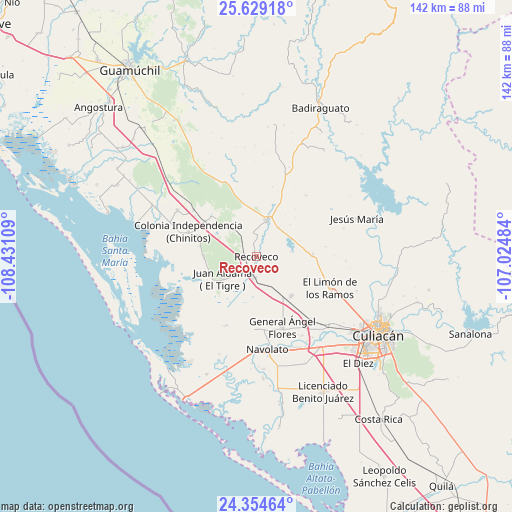
Recoveco GPS coordinates[2]
24° 59' 36.816" North, 107° 43' 40.656" West
| Map corner | latitude | longitude |
|---|---|---|
| Upper-left | 25.62918°, | -108.43109° |
| Center: | 24.99356°, | -107.72796° |
| Lower-right: | 24.35464°, | -107.02484° |
| Map W x H: | 141.7×141.7 km | = 88×88mi |
| max Lat: | 32.7° ⇑8.2% North |
| Recoveco: | 24.99356° |
| min Lat: | ⇓91.8% South 14.53588° |
| min Long | Recoveco | max Long |
| -117.105° | -107.72796° | -86.73105° |
| W 4.7%⇐ | ⇒95.3% E |
Elevation
Elevation of Recoveco is 27 m = 89 ft, and this is 1226.7 m = 4025 ft below average elevation for this country.
| Max E: |
3497 m = 11473 ft | 89% |
| Avg. | 1253.7 m = 4113 ft | |
| Recoveco | 27 m = 89 ft | |
Min E: |
-1 m = -3 ft | 11% |
See also: Mexico elevation on elevation.city.
Geographical zone
Recoveco is located in North temperate zone (between Tropic of Cancer and the Arctic Circle). Distance of this Northern Tropic circle is 173.1 km =107.6 mi to South.| Distance of | km | miles | from Recoveco |
|---|---|---|---|
| North Pole | 7228 | 4491.3 | to North |
| Arctic Circle | 4622.2 | 2872.1 | to North |
| Tropic Cancer | 173.1 | 107.6 | to South |
| Equator | 2779 | 1726.8 | to South |


Nearby cities:
15 places around Recoveco: (largest is in red/bold)
• Adolfo López Mateos (El Tamarindo)
14.5 km =9 mi,  138°
138°
• Bledal
20.7 km =12.9 mi,  203°
203°
• Ejido la Paloma
18.5 km =11.5 mi,  156°
156°
• El Limón de los Ramos
22.5 km =14 mi,  113°
113°
• El Zapotillo
15.5 km =9.6 mi,  313°
313°
• Estación Chimaneco
4.9 km =3 mi,  206°
206°
• Estación Rosales
22.9 km =14.2 mi, 139°
• General Ángel Flores (La Palma)
20.7 km =12.9 mi, 159°
• Juan Aldama (El Tigre)
11.1 km =6.9 mi,  237°
237°
• Juan Escutia
5.9 km =3.7 mi,  186°
186°
• La Campana
15.7 km =9.8 mi,  86°
86°
• Melchor Ocampo
17.8 km =11.1 mi,  289°
289°
• Pericos
10.1 km =6.3 mi,  16°
16°
• Potrero de los Sánchez (Estación Techa)
21.7 km =13.5 mi, 306°
• Rancho Viejo
14.5 km =9 mi,  348°
348°
Sources, notices
• [Note1] Compared only with cities in Mexico existing in our database
• [Src1] Map data: © OpenStreetMap contributors (CC-BY-SA)
• [Src2] Other city data from geonames.org with taken over terms of usage.
• [Src3] Geographical zone / Annual Mean Temperature by Robert A. Rohde @ Wikipedia
