Estación Chimaneco geodata
Estación Chimaneco (Sinaloa) is a populated place; located in Mexico in America/Mazatlan (GMT-7) time zone. With population of 2,041 people, there are 4269 cities with bigger population in this country. Compared to other cities in Mexico, 91.8% of cities are located further ↓South; 95.4% of cities are located further →East and 90.8% of cities have higher elevation than Estación Chimaneco. Note1


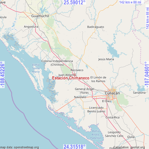
Estación Chimaneco GPS coordinates[2]
24° 57' 15.48" North, 107° 44' 56.868" West
| Map corner | latitude | longitude |
|---|---|---|
| Upper-left | 25.59012°, | -108.45226° |
| Center: | 24.9543°, | -107.74913° |
| Lower-right: | 24.31518°, | -107.04601° |
| Map W x H: | 141.8×141.8 km | = 88.1×88.1mi |
| max Lat: | 32.7° ⇑8.2% North |
| Estación Chimaneco: | 24.9543° |
| min Lat: | ⇓91.8% South 14.53588° |
| min Long | Estación Chima | max Long |
| -117.105° | -107.74913° | -86.73105° |
| W 4.6%⇐ | ⇒95.4% E |
Elevation
Elevation of Estación Chimaneco is 22 m = 72 ft, and this is 1231.7 m = 4041 ft below average elevation for this country.
| Max E: |
3497 m = 11473 ft | 90.8% |
| Avg. | 1253.7 m = 4113 ft | |
| Estación Chimaneco | 22 m = 72 ft | |
Min E: |
-1 m = -3 ft | 9.2% |
See also: Mexico elevation on elevation.city.
Geographical zone
Estación Chimaneco is located in North temperate zone (between Tropic of Cancer and the Arctic Circle). Distance of this Northern Tropic circle is 168.7 km =104.8 mi to South.| Distance of | km | miles | from Estación Chimaneco |
|---|---|---|---|
| North Pole | 7232.4 | 4494 | to North |
| Arctic Circle | 4626.5 | 2874.8 | to North |
| Tropic Cancer | 168.7 | 104.8 | to South |
| Equator | 2774.7 | 1724.1 | to South |


Nearby cities:
15 places around Estación Chimaneco: (largest is in red/bold)
• Adolfo López Mateos (El Tamarindo)
13.4 km =8.3 mi,  118°
118°
• Bachoco
18.6 km =11.6 mi,  197°
197°
• Bledal
15.9 km =9.9 mi, 203°
• Campo Cinco Hermanos (Emiliano Zapata)
19.7 km =12.2 mi,  214°
214°
• Campo Lo de Beltrán
20.6 km =12.8 mi,  138°
138°
• Ejido la Paloma
15.8 km =9.8 mi, 142°
• El Zapotillo
17.6 km =10.9 mi,  328°
328°
• General Ángel Flores (La Palma)
17.7 km =11 mi,  148°
148°
• Juan Aldama (El Tigre)
7.4 km =4.6 mi,  257°
257°
• Juan Escutia
2.1 km =1.3 mi, 135°
• La Campana
18.6 km =11.6 mi,  73°
73°
• Melchor Ocampo
17.9 km =11.1 mi,  305°
305°
• Pericos
14.9 km =9.3 mi,  19°
19°
• Rancho Viejo
18.6 km =11.6 mi,  357°
357°
• Recoveco
4.9 km =3 mi,  26°
26°
Sources, notices
• [Note1] Compared only with cities in Mexico existing in our database
• [Src1] Map data: © OpenStreetMap contributors (CC-BY-SA)
• [Src2] Other city data from geonames.org with taken over terms of usage.
• [Src3] Geographical zone / Annual Mean Temperature by Robert A. Rohde @ Wikipedia
