Presa de los Serna geodata
Presa de los Serna (Aguascalientes) is a populated place; located in Mexico in America/Mexico_City (GMT-6) time zone. With population of 639 people, there are 13559 cities with bigger population in this country. Compared to other cities in Mexico, 83% of cities are located further ↓South; 85.2% of cities are located further →East and 64.6% of cities have lower elevation than Presa de los Serna. Note1


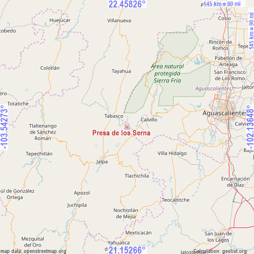
Presa de los Serna GPS coordinates[2]
21° 48' 25.02" North, 102° 50' 22.56" West
| Map corner | latitude | longitude |
|---|---|---|
| Upper-left | 22.45826°, | -103.54273° |
| Center: | 21.80695°, | -102.8396° |
| Lower-right: | 21.15266°, | -102.13648° |
| Map W x H: | 145.2×145.2 km | = 90.2×90.2mi |
| max Lat: | 32.7° ⇑17% North |
| Presa de los Serna: | 21.80695° |
| min Lat: | ⇓83% South 14.53588° |
| min Long | Presa de los Se | max Long |
| -117.105° | -102.8396° | -86.73105° |
| W 14.8%⇐ | ⇒85.2% E |
Elevation
Elevation of Presa de los Serna is 1817 m = 5961 ft, and this is 563.3 m = 1848 ft above average elevation for this country.
| Max E: |
3497 m = 11473 ft | 35.4% |
| Presa de los Serna | 1817 m 5961 ft | |
| Avg. | 1253.7 m = 4113 ft | |
Min E: |
-1 m = -3 ft | 64.6% |
See also: Mexico elevation on elevation.city.
Geographical zone
Presa de los Serna is located in North Torrid zone (between Equator and Tropic of Cancer). Distance of this Northern Tropic circle is 181.2 km =112.6 mi to North.| Distance of | km | miles | from Presa de los Serna |
|---|---|---|---|
| North Pole | 7582.4 | 4711.5 | to North |
| Arctic Circle | 4976.5 | 3092.3 | to North |
| Tropic Cancer | 181.2 | 112.6 | to North |
| Equator | 2424.7 | 1506.6 | to South |


Nearby cities:
15 places around Presa de los Serna: (largest is in red/bold)
• Calvillo
13.2 km =8.2 mi,  70°
70°
• Crucero Las Pilas
8.5 km =5.3 mi, 74°
• El Cuervero (Cuerveros)
17.1 km =10.6 mi, 69°
• El Salitre
7.2 km =4.5 mi,  77°
77°
• Huanusco
14.3 km =8.9 mi,  255°
255°
• Huiscolco
14.6 km =9.1 mi,  311°
311°
• Jaltiche de Arriba
6.3 km =3.9 mi,  123°
123°
• La Panadera
15.9 km =9.9 mi, 66°
• La Rinconada
4.7 km =2.9 mi,  114°
114°
• Mesa Grande
12.2 km =7.6 mi,  90°
90°
• Ojo de Agua
6 km =3.7 mi,  103°
103°
• Ojocaliente
18.4 km =11.4 mi, 66°
• Solidaridad [Fraccionamiento]
16.4 km =10.2 mi,  57°
57°
• Tabasco
9.6 km =6 mi, 310°
• Valle Huejúcar (Fraccionamiento Popular) [Fraccionamiento]
9.6 km =6 mi, 73°
Sources, notices
• [Note1] Compared only with cities in Mexico existing in our database
• [Src1] Map data: © OpenStreetMap contributors (CC-BY-SA)
• [Src2] Other city data from geonames.org with taken over terms of usage.
• [Src3] Geographical zone / Annual Mean Temperature by Robert A. Rohde @ Wikipedia
