El Vergel geodata
El Vergel (Sinaloa) is a populated place; located in Mexico in America/Mazatlan (GMT-7) time zone. With population of 888 people, there are 9821 cities with bigger population in this country. Compared to other cities in Mexico, 91.3% of cities are located further ↓South; 95.4% of cities are located further →East and 98.1% of cities have higher elevation than El Vergel. Note1


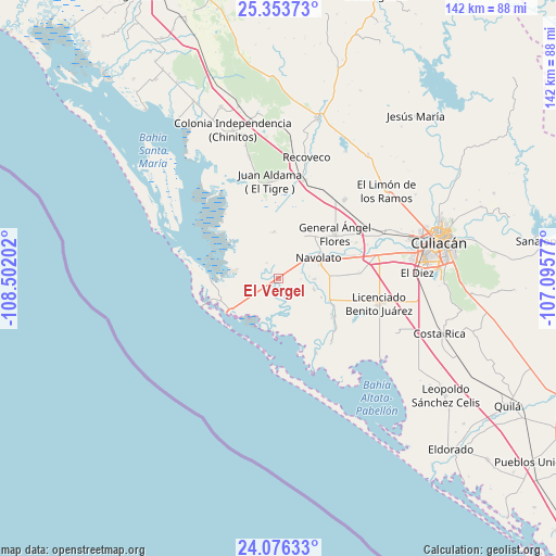
El Vergel GPS coordinates[2]
24° 43' 0.012" North, 107° 47' 56.004" West
| Map corner | latitude | longitude |
|---|---|---|
| Upper-left | 25.35373°, | -108.50202° |
| Center: | 24.71667°, | -107.79889° |
| Lower-right: | 24.07633°, | -107.09577° |
| Map W x H: | 142×142 km | = 88.2×88.2mi |
| max Lat: | 32.7° ⇑8.7% North |
| El Vergel: | 24.71667° |
| min Lat: | ⇓91.3% South 14.53588° |
| min Long | El Vergel | max Long |
| -117.105° | -107.79889° | -86.73105° |
| W 4.6%⇐ | ⇒95.4% E |
Elevation
Elevation of El Vergel is 8 m = 26 ft, and this is 1245.7 m = 4087 ft below average elevation for this country.
| Max E: |
3497 m = 11473 ft | 98.1% |
| Avg. | 1253.7 m = 4113 ft | |
| El Vergel | 8 m = 26 ft | |
Min E: |
-1 m = -3 ft | 1.9% |
See also: Mexico elevation on elevation.city.
Geographical zone
El Vergel is located in North temperate zone (between Tropic of Cancer and the Arctic Circle). Distance of this Northern Tropic circle is 142.3 km =88.4 mi to South.| Distance of | km | miles | from El Vergel |
|---|---|---|---|
| North Pole | 7258.8 | 4510.4 | to North |
| Arctic Circle | 4652.9 | 2891.2 | to North |
| Tropic Cancer | 142.3 | 88.4 | to South |
| Equator | 2748.2 | 1707.7 | to South |


Nearby cities:
15 places around El Vergel: (largest is in red/bold)
• Bachimeto
6.2 km =3.9 mi,  63°
63°
• Bachoco
8.7 km =5.4 mi,  357°
357°
• Bledal
11.9 km =7.4 mi,  354°
354°
• Campo Cinco Hermanos (Emiliano Zapata)
11.9 km =7.4 mi,  329°
329°
• El Potrero de Sataya
9.5 km =5.9 mi,  108°
108°
• Ezequiel Leyva (Tacuache)
0.4 km =0.2 mi,  131°
131°
• La Bandera
6.7 km =4.2 mi,  255°
255°
• La Vuelta
9.3 km =5.8 mi,  91°
91°
• Las Trancas
5.7 km =3.5 mi, 92°
• Licenciado Alfredo Valdez Montoya
2.8 km =1.7 mi,  236°
236°
• Lo de Reyes
5.5 km =3.4 mi,  30°
30°
• Navolato
11.2 km =7 mi, 60°
• Otameto
6.1 km =3.8 mi,  77°
77°
• Rosa Morada
12 km =7.5 mi, 114°
• Tabolato
8.5 km =5.3 mi, 62°
Sources, notices
• [Note1] Compared only with cities in Mexico existing in our database
• [Src1] Map data: © OpenStreetMap contributors (CC-BY-SA)
• [Src2] Other city data from geonames.org with taken over terms of usage.
• [Src3] Geographical zone / Annual Mean Temperature by Robert A. Rohde @ Wikipedia
