Navacoyán geodata
Navacoyán (Durango) is a populated place; located in Mexico in America/Monterrey (GMT-6) time zone. With population of 622 people, there are 13890 cities with bigger population in this country. Compared to other cities in Mexico, 90.2% of cities are located further ↓South; 91.1% of cities are located further →East and 66.8% of cities have lower elevation than Navacoyán. Note1


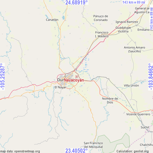
Navacoyán GPS coordinates[2]
24° 2' 55.356" North, 104° 32' 59.064" West
| Map corner | latitude | longitude |
|---|---|---|
| Upper-left | 24.68919°, | -105.25287° |
| Center: | 24.04871°, | -104.54974° |
| Lower-right: | 23.40502°, | -103.84662° |
| Map W x H: | 142.8×142.8 km | = 88.7×88.7mi |
| max Lat: | 32.7° ⇑9.8% North |
| Navacoyán: | 24.04871° |
| min Lat: | ⇓90.2% South 14.53588° |
| min Long | Navacoyán | max Long |
| -117.105° | -104.54974° | -86.73105° |
| W 8.9%⇐ | ⇒91.1% E |
Elevation
Elevation of Navacoyán is 1865 m = 6119 ft, and this is 611.3 m = 2006 ft above average elevation for this country.
| Max E: |
3497 m = 11473 ft | 33.2% |
| Navacoyán | 1865 m 6119 ft | |
| Avg. | 1253.7 m = 4113 ft | |
Min E: |
-1 m = -3 ft | 66.8% |
See also: Mexico elevation on elevation.city.
Geographical zone
Navacoyán is located in North temperate zone (between Tropic of Cancer and the Arctic Circle). Distance of this Northern Tropic circle is 68 km =42.3 mi to South.| Distance of | km | miles | from Navacoyán |
|---|---|---|---|
| North Pole | 7333.1 | 4556.6 | to North |
| Arctic Circle | 4727.2 | 2937.3 | to North |
| Tropic Cancer | 68 | 42.3 | to South |
| Equator | 2674 | 1661.5 | to South |


Nearby cities:
15 places around Navacoyán: (largest is in red/bold)
• Aquiles Serdán
12.3 km =7.6 mi,  195°
195°
• Cinco de Febrero
5.5 km =3.4 mi,  55°
55°
• Cinco de Mayo
6.4 km =4 mi,  336°
336°
• Contreras
1.3 km =0.8 mi,  213°
213°
• Dolores Hidalgo
5.7 km =3.5 mi, 204°
• El Arenal
11.9 km =7.4 mi,  81°
81°
• Gabino Santillán
8.9 km =5.5 mi, 211°
• Hidalgo
12.7 km =7.9 mi, 344°
• José Refugio Salcido
9.9 km =6.2 mi,  161°
161°
• Labor de Guadalupe
13.6 km =8.5 mi, 339°
• Parras de la Fuente
6 km =3.7 mi, 162°
• Praxedis G. Guerrero Nuevo (La Loma)
12.1 km =7.5 mi,  187°
187°
• Sebastián Lerdo de Tejada
13.7 km =8.5 mi,  220°
220°
• Victoria de Durango
11.4 km =7.1 mi,  253°
253°
• Villa Montemorelos
9.5 km =5.9 mi,  132°
132°
Sources, notices
• [Note1] Compared only with cities in Mexico existing in our database
• [Src1] Map data: © OpenStreetMap contributors (CC-BY-SA)
• [Src2] Other city data from geonames.org with taken over terms of usage.
• [Src3] Geographical zone / Annual Mean Temperature by Robert A. Rohde @ Wikipedia
