Nacaveba geodata
Nacaveba (Sinaloa) is a populated place; located in Mexico in America/Mazatlan (GMT-7) time zone. With population of 906 people, there are 9634 cities with bigger population in this country. Compared to other cities in Mexico, 94.1% of cities are located further ↓South; 95.6% of cities are located further →East and 74.9% of cities have higher elevation than Nacaveba. Note1


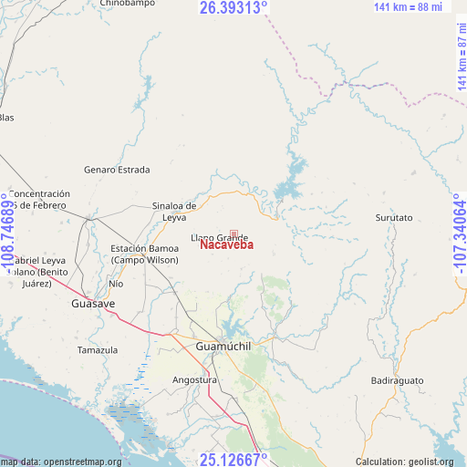
Nacaveba GPS coordinates[2]
25° 45' 41.724" North, 108° 2' 37.536" West
| Map corner | latitude | longitude |
|---|---|---|
| Upper-left | 26.39313°, | -108.74689° |
| Center: | 25.76159°, | -108.04376° |
| Lower-right: | 25.12667°, | -107.34064° |
| Map W x H: | 140.8×140.8 km | = 87.5×87.5mi |
| max Lat: | 32.7° ⇑5.9% North |
| Nacaveba: | 25.76159° |
| min Lat: | ⇓94.1% South 14.53588° |
| min Long | Nacaveba | max Long |
| -117.105° | -108.04376° | -86.73105° |
| W 4.4%⇐ | ⇒95.6% E |
Elevation
Elevation of Nacaveba is 225 m = 738 ft, and this is 1028.7 m = 3375 ft below average elevation for this country.
| Max E: |
3497 m = 11473 ft | 74.9% |
| Avg. | 1253.7 m = 4113 ft | |
| Nacaveba | 225 m = 738 ft | |
Min E: |
-1 m = -3 ft | 25.1% |
See also: Mexico elevation on elevation.city.
Geographical zone
Nacaveba is located in North temperate zone (between Tropic of Cancer and the Arctic Circle). Distance of this Northern Tropic circle is 258.5 km =160.6 mi to South.| Distance of | km | miles | from Nacaveba |
|---|---|---|---|
| North Pole | 7142.6 | 4438.2 | to North |
| Arctic Circle | 4536.8 | 2819 | to North |
| Tropic Cancer | 258.5 | 160.6 | to South |
| Equator | 2864.4 | 1779.9 | to South |


Nearby cities:
15 places around Nacaveba: (largest is in red/bold)
• Agua Blanca
14.7 km =9.1 mi,  330°
330°
• Baburia
18.3 km =11.4 mi,  299°
299°
• Bacubirito
13.9 km =8.6 mi,  67°
67°
• Buenavista
13.6 km =8.5 mi, 325°
• Cerro Agudo
19.9 km =12.4 mi,  156°
156°
• Cubiri de Portelas
21.8 km =13.5 mi,  277°
277°
• Cubiri de la Loma
22.9 km =14.2 mi,  270°
270°
• El Coyote
22 km =13.7 mi,  243°
243°
• El Opochi
17.1 km =10.6 mi,  291°
291°
• El Pueblito (El Realito)
13 km =8.1 mi,  311°
311°
• Higuera de los Vega
14.7 km =9.1 mi,  143°
143°
• Llano Grande
4.4 km =2.7 mi,  255°
255°
• Maripa
16.1 km =10 mi, 314°
• Maripita
16.8 km =10.4 mi, 307°
• Sinaloa de Leyva
19.1 km =11.9 mi, 290°
Sources, notices
• [Note1] Compared only with cities in Mexico existing in our database
• [Src1] Map data: © OpenStreetMap contributors (CC-BY-SA)
• [Src2] Other city data from geonames.org with taken over terms of usage.
• [Src3] Geographical zone / Annual Mean Temperature by Robert A. Rohde @ Wikipedia
