Mulanjey geodata
Mulanjey (Sinaloa) is a populated place; located in Mexico in America/Mazatlan (GMT-7) time zone. With population of 595 people, there are 14451 cities with bigger population in this country. Compared to other cities in Mexico, 95.5% of cities are located further ↓South; 96.6% of cities are located further →East and 84.7% of cities have higher elevation than Mulanjey. Note1


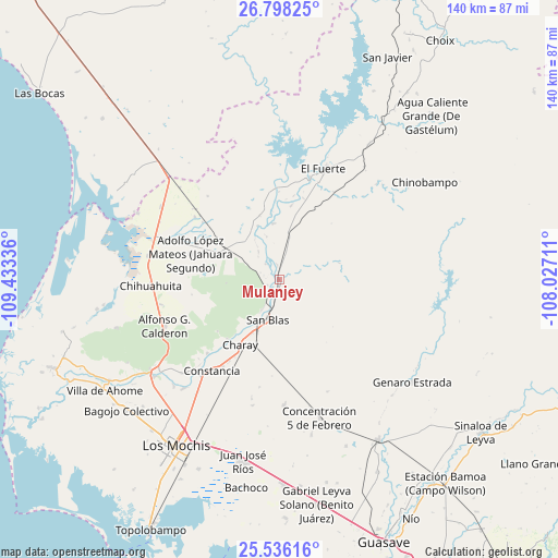
Mulanjey GPS coordinates[2]
26° 10' 8.076" North, 108° 43' 48.828" West
| Map corner | latitude | longitude |
|---|---|---|
| Upper-left | 26.79825°, | -109.43336° |
| Center: | 26.16891°, | -108.73023° |
| Lower-right: | 25.53616°, | -108.02711° |
| Map W x H: | 140.3×140.3 km | = 87.2×87.2mi |
| max Lat: | 32.7° ⇑4.5% North |
| Mulanjey: | 26.16891° |
| min Lat: | ⇓95.5% South 14.53588° |
| min Long | Mulanjey | max Long |
| -117.105° | -108.73023° | -86.73105° |
| W 3.4%⇐ | ⇒96.6% E |
Elevation
Elevation of Mulanjey is 46 m = 151 ft, and this is 1207.7 m = 3962 ft below average elevation for this country.
| Max E: |
3497 m = 11473 ft | 84.7% |
| Avg. | 1253.7 m = 4113 ft | |
| Mulanjey | 46 m = 151 ft | |
Min E: |
-1 m = -3 ft | 15.3% |
See also: Mexico elevation on elevation.city.
Geographical zone
Mulanjey is located in North temperate zone (between Tropic of Cancer and the Arctic Circle). Distance of this Northern Tropic circle is 303.8 km =188.8 mi to South.| Distance of | km | miles | from Mulanjey |
|---|---|---|---|
| North Pole | 7097.4 | 4410.1 | to North |
| Arctic Circle | 4491.5 | 2790.9 | to North |
| Tropic Cancer | 303.8 | 188.8 | to South |
| Equator | 2909.7 | 1808 | to South |


Nearby cities:
15 places around Mulanjey: (largest is in red/bold)
• Boca de Arroyo
16.7 km =10.4 mi,  351°
351°
• Campo Seco (Tres de Mayo)
20.1 km =12.5 mi,  208°
208°
• Charay
19.2 km =11.9 mi, 211°
• Colonia 12 de Agosto
22.2 km =13.8 mi,  287°
287°
• El Pochotal
22.4 km =13.9 mi, 210°
• La Bajada del Monte
18.9 km =11.7 mi,  9°
9°
• La Palma
19.9 km =12.4 mi,  220°
220°
• Las Estacas
11.1 km =6.9 mi,  342°
342°
• Lázaro Cárdenas
15 km =9.3 mi, 207°
• Macoyahui
13.5 km =8.4 mi,  204°
204°
• Mulanjey (Estación Vega)
0 km =0 mi, 350°
• San Blas
10.3 km =6.4 mi, 197°
• Sibajahui
2.3 km =1.4 mi, 196°
• Tehueco
14.2 km =8.8 mi, 353°
• Tepic
22.5 km =14 mi, 294°
Sources, notices
• [Note1] Compared only with cities in Mexico existing in our database
• [Src1] Map data: © OpenStreetMap contributors (CC-BY-SA)
• [Src2] Other city data from geonames.org with taken over terms of usage.
• [Src3] Geographical zone / Annual Mean Temperature by Robert A. Rohde @ Wikipedia
