Tehueco geodata
Tehueco (Sinaloa) is a populated place; located in Mexico in America/Mazatlan (GMT-7) time zone. With population of 859 people, there are 10183 cities with bigger population in this country. Compared to other cities in Mexico, 95.6% of cities are located further ↓South; 96.6% of cities are located further →East and 83.5% of cities have higher elevation than Tehueco. Note1


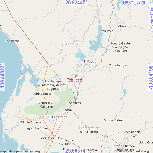
Tehueco GPS coordinates[2]
26° 17' 44.916" North, 108° 44' 42.36" West
| Map corner | latitude | longitude |
|---|---|---|
| Upper-left | 26.92445°, | -109.44823° |
| Center: | 26.29581°, | -108.7451° |
| Lower-right: | 25.66374°, | -108.04198° |
| Map W x H: | 140.2×140.2 km | = 87.1×87.1mi |
| max Lat: | 32.7° ⇑4.4% North |
| Tehueco: | 26.29581° |
| min Lat: | ⇓95.6% South 14.53588° |
| min Long | Tehueco | max Long |
| -117.105° | -108.7451° | -86.73105° |
| W 3.4%⇐ | ⇒96.6% E |
Elevation
Elevation of Tehueco is 56 m = 184 ft, and this is 1197.7 m = 3929 ft below average elevation for this country.
| Max E: |
3497 m = 11473 ft | 83.5% |
| Avg. | 1253.7 m = 4113 ft | |
| Tehueco | 56 m = 184 ft | |
Min E: |
-1 m = -3 ft | 16.5% |
See also: Mexico elevation on elevation.city.
Geographical zone
Tehueco is located in North temperate zone (between Tropic of Cancer and the Arctic Circle). Distance of this Northern Tropic circle is 317.9 km =197.5 mi to South.| Distance of | km | miles | from Tehueco |
|---|---|---|---|
| North Pole | 7083.2 | 4401.3 | to North |
| Arctic Circle | 4477.4 | 2782.1 | to North |
| Tropic Cancer | 317.9 | 197.5 | to South |
| Equator | 2923.8 | 1816.8 | to South |


Nearby cities:
15 places around Tehueco: (largest is in red/bold)
• Baroten
14.8 km =9.2 mi,  37°
37°
• Boca de Arroyo
2.5 km =1.6 mi,  339°
339°
• Colonia 12 de Agosto
21 km =13 mi,  249°
249°
• El Canutillo
14.8 km =9.2 mi,  54°
54°
• El Fuerte
18.5 km =11.5 mi, 43°
• Estación Hoyancos (Estación el Fuerte)
17.1 km =10.6 mi,  62°
62°
• La Bajada del Monte
6.4 km =4 mi, 44°
• Las Estacas
3.9 km =2.4 mi,  206°
206°
• Lázaro Cárdenas
17.9 km =11.1 mi,  271°
271°
• Mulanjey
14.2 km =8.8 mi,  173°
173°
• Mulanjey (Estación Vega)
14.2 km =8.8 mi, 174°
• Palo Verde
18.6 km =11.6 mi,  276°
276°
• Revolución Mexicana
19.9 km =12.4 mi, 274°
• Sibajahui
16.3 km =10.1 mi,  177°
177°
• Tepic
19.6 km =12.2 mi,  255°
255°
Sources, notices
• [Note1] Compared only with cities in Mexico existing in our database
• [Src1] Map data: © OpenStreetMap contributors (CC-BY-SA)
• [Src2] Other city data from geonames.org with taken over terms of usage.
• [Src3] Geographical zone / Annual Mean Temperature by Robert A. Rohde @ Wikipedia
