Mulanjey (Estación Vega) geodata
Mulanjey (Estación Vega) (Sinaloa) is a populated place; located in Mexico in America/Mazatlan (GMT-7) time zone. With population of 595 people, there are 14451 cities with bigger population in this country. Compared to other cities in Mexico, 95.5% of cities are located further ↓South; 96.6% of cities are located further →East and 84.7% of cities have higher elevation than Mulanjey (Estación Vega). Note1
Current local time in Mulanjey (Estación Vega):
10:18 AM, MondayDifference from your time zone: hours


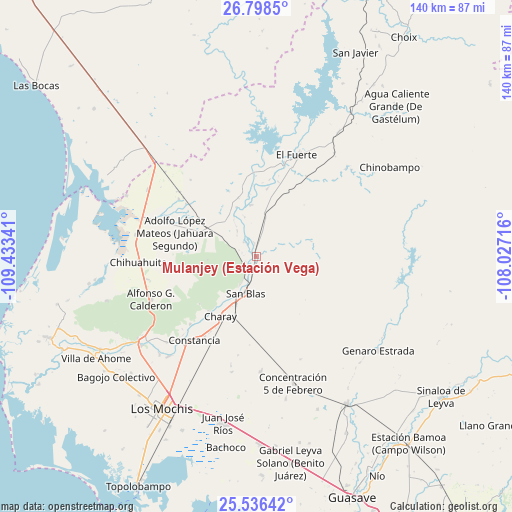
Mulanjey (Estación Vega) GPS coordinates[2]
26° 10' 9.012" North, 108° 43' 49.008" West
| Map corner | latitude | longitude |
|---|---|---|
| Upper-left | 26.7985°, | -109.43341° |
| Center: | 26.16917°, | -108.73028° |
| Lower-right: | 25.53642°, | -108.02716° |
| Map W x H: | 140.3×140.3 km | = 87.2×87.2mi |
| max Lat: | 32.7° ⇑4.5% North |
| Mulanjey (Estación Vega): | 26.16917° |
| min Lat: | ⇓95.5% South 14.53588° |
| min Long | Mulanjey (Estac | max Long |
| -117.105° | -108.73028° | -86.73105° |
| W 3.4%⇐ | ⇒96.6% E |
Elevation
Elevation of Mulanjey (Estación Vega) is 46 m = 151 ft, and this is 1207.7 m = 3962 ft below average elevation for this country.
| Max E: |
3497 m = 11473 ft | 84.7% |
| Avg. | 1253.7 m = 4113 ft | |
| Mulanjey (Estación Vega) | 46 m = 151 ft | |
Min E: |
-1 m = -3 ft | 15.3% |
See also: Mexico elevation on elevation.city.
Geographical zone
Mulanjey (Estación Vega) is located in North temperate zone (between Tropic of Cancer and the Arctic Circle). Distance of this Northern Tropic circle is 303.8 km =188.8 mi to South.| Distance of | km | miles | from Mulanjey (Estación Vega) |
|---|---|---|---|
| North Pole | 7097.3 | 4410.1 | to North |
| Arctic Circle | 4491.4 | 2790.8 | to North |
| Tropic Cancer | 303.8 | 188.8 | to South |
| Equator | 2909.7 | 1808 | to South |


Nearby cities:
15 places around Mulanjey (Estación Vega): (largest is in red/bold)
• Boca de Arroyo
16.6 km =10.3 mi,  351°
351°
• Campo Seco (Tres de Mayo)
20.1 km =12.5 mi,  208°
208°
• Charay
19.3 km =12 mi, 211°
• Colonia 12 de Agosto
22.2 km =13.8 mi,  287°
287°
• El Pochotal
22.4 km =13.9 mi, 210°
• La Bajada del Monte
18.9 km =11.7 mi,  9°
9°
• La Palma
19.9 km =12.4 mi,  220°
220°
• Las Estacas
11.1 km =6.9 mi,  342°
342°
• Lázaro Cárdenas
15 km =9.3 mi, 207°
• Macoyahui
13.5 km =8.4 mi,  203°
203°
• Mulanjey
0 km =0 mi,  170°
170°
• San Blas
10.4 km =6.5 mi, 197°
• Sibajahui
2.3 km =1.4 mi, 196°
• Tehueco
14.2 km =8.8 mi, 354°
• Tepic
22.5 km =14 mi, 294°
Sources, notices
• [Note1] Compared only with cities in Mexico existing in our database
• [Src1] Map data: © OpenStreetMap contributors (CC-BY-SA)
• [Src2] Other city data from geonames.org with taken over terms of usage.
• [Src3] Geographical zone / Annual Mean Temperature by Robert A. Rohde @ Wikipedia
