Los Pocitos geodata
Los Pocitos (Querétaro) is a populated place; located in Mexico in America/Mexico_City (GMT-6) time zone. With population of 2,264 people, there are 3885 cities with bigger population in this country. Compared to other cities in Mexico, 73.3% of cities are located further ↓South; 67.5% of cities are located further →East and 76.5% of cities have lower elevation than Los Pocitos. Note1


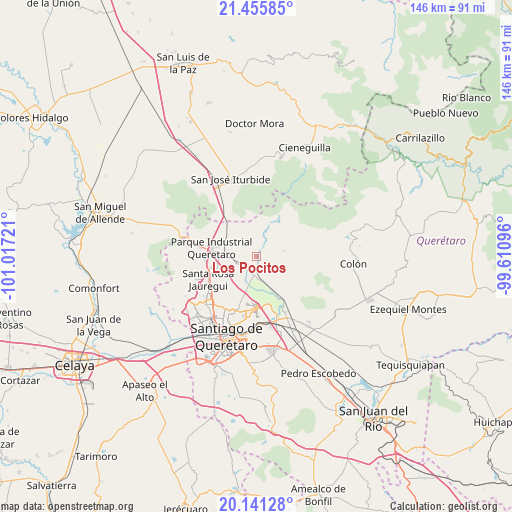
Los Pocitos GPS coordinates[2]
20° 48' 0" North, 100° 18' 50.688" West
| Map corner | latitude | longitude |
|---|---|---|
| Upper-left | 21.45585°, | -101.01721° |
| Center: | 20.8°, | -100.31408° |
| Lower-right: | 20.14128°, | -99.61096° |
| Map W x H: | 146.2×146.2 km | = 90.8×90.8mi |
| max Lat: | 32.7° ⇑26.7% North |
| Los Pocitos: | 20.8° |
| min Lat: | ⇓73.3% South 14.53588° |
| min Long | Los Pocitos | max Long |
| -117.105° | -100.31408° | -86.73105° |
| W 32.5%⇐ | ⇒67.5% E |
Elevation
Elevation of Los Pocitos is 2058 m = 6752 ft, and this is 804.3 m = 2639 ft above average elevation for this country.
| Max E: |
3497 m = 11473 ft | 23.5% |
| Los Pocitos | 2058 m 6752 ft | |
| Avg. | 1253.7 m = 4113 ft | |
Min E: |
-1 m = -3 ft | 76.5% |
See also: Mexico elevation on elevation.city.
Geographical zone
Los Pocitos is located in North Torrid zone (between Equator and Tropic of Cancer). Distance of this Northern Tropic circle is 293.2 km =182.2 mi to North.| Distance of | km | miles | from Los Pocitos |
|---|---|---|---|
| North Pole | 7694.3 | 4781 | to North |
| Arctic Circle | 5088.4 | 3161.8 | to North |
| Tropic Cancer | 293.2 | 182.2 | to North |
| Equator | 2312.7 | 1437 | to South |


Nearby cities:
15 places around Los Pocitos: (largest is in red/bold)
• Atongo
8.3 km =5.2 mi,  111°
111°
• Chichimequillas
4.5 km =2.8 mi,  210°
210°
• El Pinto
10.1 km =6.3 mi,  271°
271°
• La Estacada
10 km =6.2 mi,  283°
283°
• La Gotera
9.5 km =5.9 mi,  317°
317°
• La Laborcilla
8.4 km =5.2 mi,  18°
18°
• Las Lajitas
9.1 km =5.7 mi, 272°
• Los Baños
1.1 km =0.7 mi,  174°
174°
• Presa de Rayas
9.5 km =5.9 mi,  85°
85°
• San Miguel Amazcala
9.8 km =6.1 mi,  123°
123°
• San Rafael
6 km =3.7 mi,  150°
150°
• San Vicente Ferrer
8.8 km =5.5 mi,  202°
202°
• Santa Cruz
9.9 km =6.2 mi, 173°
• Santa María Begoña
5.9 km =3.7 mi,  183°
183°
• Tierra Blanca
7.2 km =4.5 mi,  252°
252°
Sources, notices
• [Note1] Compared only with cities in Mexico existing in our database
• [Src1] Map data: © OpenStreetMap contributors (CC-BY-SA)
• [Src2] Other city data from geonames.org with taken over terms of usage.
• [Src3] Geographical zone / Annual Mean Temperature by Robert A. Rohde @ Wikipedia
