Loreto geodata
Loreto (Baja California Sur) is a populated place; located in Mexico in America/Mazatlan (GMT-7) time zone. With population of 14,724 people, there are 658 cities with bigger population in this country. Compared to other cities in Mexico, 95.4% of cities are located further ↓South; 98.7% of cities are located further →East and 98.1% of cities have higher elevation than Loreto. Note1


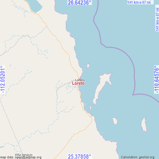
Loreto GPS coordinates[2]
26° 0' 43.812" North, 111° 20' 55.968" West
| Map corner | latitude | longitude |
|---|---|---|
| Upper-left | 26.64236°, | -112.05201° |
| Center: | 26.01217°, | -111.34888° |
| Lower-right: | 25.37858°, | -110.64576° |
| Map W x H: | 140.5×140.5 km | = 87.3×87.3mi |
| max Lat: | 32.7° ⇑4.6% North |
| Loreto: | 26.01217° |
| min Lat: | ⇓95.4% South 14.53588° |
| min Long | Loreto | max Long |
| -117.105° | -111.34888° | -86.73105° |
| W 1.3%⇐ | ⇒98.7% E |
Elevation
Elevation of Loreto is 8 m = 26 ft, and this is 1245.7 m = 4087 ft below average elevation for this country.
| Max E: |
3497 m = 11473 ft | 98.1% |
| Avg. | 1253.7 m = 4113 ft | |
| Loreto | 8 m = 26 ft | |
Min E: |
-1 m = -3 ft | 1.9% |
See also: Mexico elevation on elevation.city.
Geographical zone
Loreto is located in North temperate zone (between Tropic of Cancer and the Arctic Circle). Distance of this Northern Tropic circle is 286.4 km =178 mi to South.| Distance of | km | miles | from Loreto |
|---|---|---|---|
| North Pole | 7114.8 | 4420.9 | to North |
| Arctic Circle | 4508.9 | 2801.7 | to North |
| Tropic Cancer | 286.4 | 178 | to South |
| Equator | 2892.3 | 1797.2 | to South |


Nearby cities:
15 places around Loreto: (largest is in red/bold)
• Bahía de Lobos
173.4 km =107.7 mi,  30°
30°
• Benito Juárez
110.6 km =68.7 mi,  205°
205°
• Ciudad Constitución
113.4 km =70.5 mi,  196°
196°
• Ciudad Insurgentes
93.5 km =58.1 mi, 207°
• Ejido San Lucas
160.2 km =99.5 mi,  327°
327°
• Las Milpas
179.7 km =111.7 mi,  60°
60°
• Ley Federal de Aguas Número Uno
80.6 km =50.1 mi, 201°
• Mulegé
116.3 km =72.3 mi, 327°
• Puerto Adolfo Lopez Mateos
119.3 km =74.1 mi,  220°
220°
• Puerto San Carlos
155.8 km =96.8 mi, 209°
• San Bruno
151 km =93.8 mi, 327°
• San Juanico
116.1 km =72.1 mi,  283°
283°
• Santa Rosalía
173.6 km =107.9 mi, 328°
• Valle Santo Domingo
81.5 km =50.6 mi, 224°
• Villa Morelos
123.5 km =76.7 mi,  193°
193°
Sources, notices
• [Note1] Compared only with cities in Mexico existing in our database
• [Src1] Map data: © OpenStreetMap contributors (CC-BY-SA)
• [Src2] Other city data from geonames.org with taken over terms of usage.
• [Src3] Geographical zone / Annual Mean Temperature by Robert A. Rohde @ Wikipedia
