San Juanico geodata
San Juanico (Baja California Sur) is a populated place; located in Mexico in America/Mazatlan (GMT-7) time zone. With population of 647 people, there are 13375 cities with bigger population in this country. Compared to other cities in Mexico, 95.6% of cities are located further ↓South; 98.9% of cities are located further →East and 92.5% of cities have higher elevation than San Juanico. Note1


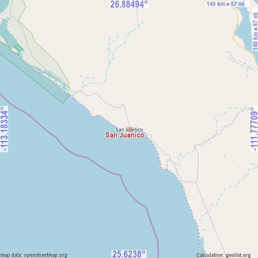
San Juanico GPS coordinates[2]
26° 15' 21.888" North, 112° 28' 48.756" West
| Map corner | latitude | longitude |
|---|---|---|
| Upper-left | 26.88494°, | -113.18334° |
| Center: | 26.25608°, | -112.48021° |
| Lower-right: | 25.6238°, | -111.77709° |
| Map W x H: | 140.2×140.2 km | = 87.1×87.1mi |
| max Lat: | 32.7° ⇑4.4% North |
| San Juanico: | 26.25608° |
| min Lat: | ⇓95.6% South 14.53588° |
| min Long | San Juanico | max Long |
| -117.105° | -112.48021° | -86.73105° |
| W 1.1%⇐ | ⇒98.9% E |
Elevation
Elevation of San Juanico is 18 m = 59 ft, and this is 1235.7 m = 4054 ft below average elevation for this country.
| Max E: |
3497 m = 11473 ft | 92.5% |
| Avg. | 1253.7 m = 4113 ft | |
| San Juanico | 18 m = 59 ft | |
Min E: |
-1 m = -3 ft | 7.5% |
See also: Mexico elevation on elevation.city.
Geographical zone
San Juanico is located in North temperate zone (between Tropic of Cancer and the Arctic Circle). Distance of this Northern Tropic circle is 313.5 km =194.8 mi to South.| Distance of | km | miles | from San Juanico |
|---|---|---|---|
| North Pole | 7087.7 | 4404.1 | to North |
| Arctic Circle | 4481.8 | 2784.9 | to North |
| Tropic Cancer | 313.5 | 194.8 | to South |
| Equator | 2919.4 | 1814 | to South |


Nearby cities:
15 places around San Juanico: (largest is in red/bold)
• Benito Juárez
142.7 km =88.7 mi,  152°
152°
• Ciudad Constitución
158.9 km =98.7 mi, 148°
• Ciudad Insurgentes
131.1 km =81.5 mi, 147°
• Ejido San Lucas
110.4 km =68.6 mi,  13°
13°
• El Silencio
157.4 km =97.8 mi,  328°
328°
• Ley Federal de Aguas Número Uno
132.5 km =82.3 mi,  140°
140°
• Loreto
116.1 km =72.1 mi,  103°
103°
• Los Mártires Uno
141.9 km =88.2 mi, 328°
• Mulegé
86.2 km =53.6 mi,  35°
35°
• Puerto Adolfo Lopez Mateos
123.8 km =76.9 mi,  162°
162°
• Punta Abreojos
120.3 km =74.8 mi,  295°
295°
• San Bruno
105.5 km =65.6 mi,  17°
17°
• San Ignacio
121.4 km =75.4 mi,  340°
340°
• Santa Rosalía
122.4 km =76.1 mi, 9°
• Valle Santo Domingo
102 km =63.4 mi, 146°
Sources, notices
• [Note1] Compared only with cities in Mexico existing in our database
• [Src1] Map data: © OpenStreetMap contributors (CC-BY-SA)
• [Src2] Other city data from geonames.org with taken over terms of usage.
• [Src3] Geographical zone / Annual Mean Temperature by Robert A. Rohde @ Wikipedia
