Ley Federal de Aguas Número Uno geodata
Ley Federal de Aguas Número Uno (Baja California Sur) is a populated place; located in Mexico in America/Mazatlan (GMT-7) time zone. With population of 505 people, there are 16660 cities with bigger population in this country. Compared to other cities in Mexico, 92.2% of cities are located further ↓South; 98.8% of cities are located further →East and 82.6% of cities have higher elevation than Ley Federal de Aguas Número Uno. Note1
Current local time in Ley Federal de Aguas Número Uno:
07:28 AM, WednesdayDifference from your time zone: hours


Ley Federal de Aguas Número Uno GPS coordinates[2]
25° 20' 10.104" North, 111° 38' 22.2" West
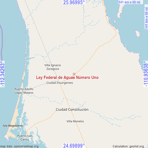
| Map corner | latitude | longitude |
|---|---|---|
| Upper-left | 25.96995°, | -112.34263° |
| Center: | 25.33614°, | -111.6395° |
| Lower-right: | 24.69899°, | -110.93638° |
| Map W x H: | 141.3×141.3 km | = 87.8×87.8mi |
| max Lat: | 32.7° ⇑7.8% North |
| Ley Federal de Aguas Número Uno: | 25.33614° |
| min Lat: | ⇓92.2% South 14.53588° |
| min Long | Ley Federal de | max Long |
| -117.105° | -111.6395° | -86.73105° |
| W 1.2%⇐ | ⇒98.8% E |
Elevation
Elevation of Ley Federal de Aguas Número Uno is 64 m = 210 ft, and this is 1189.7 m = 3903 ft below average elevation for this country.
| Max E: |
3497 m = 11473 ft | 82.6% |
| Avg. | 1253.7 m = 4113 ft | |
| Ley Federal de Aguas Número Uno | 64 m = 210 ft | |
Min E: |
-1 m = -3 ft | 17.4% |
See also: Mexico elevation on elevation.city.
Geographical zone
Ley Federal de Aguas Número Uno is located in North temperate zone (between Tropic of Cancer and the Arctic Circle). Distance of this Northern Tropic circle is 211.2 km =131.2 mi to South.| Distance of | km | miles | from Ley Federal de Aguas Número Uno |
|---|---|---|---|
| North Pole | 7189.9 | 4467.6 | to North |
| Arctic Circle | 4584.1 | 2848.4 | to North |
| Tropic Cancer | 211.2 | 131.2 | to South |
| Equator | 2817.1 | 1750.5 | to South |


Nearby cities:
15 places around Ley Federal de Aguas Número Uno: (largest is in red/bold)
• Benito Juárez
30.9 km =19.2 mi,  217°
217°
• Chametla
187.8 km =116.7 mi,  137°
137°
• Ciudad Constitución
33.9 km =21.1 mi,  183°
183°
• Ciudad Insurgentes
15.8 km =9.8 mi,  239°
239°
• El Centenario
184.7 km =114.8 mi, 137°
• La Paz
189.3 km =117.6 mi,  134°
134°
• Loreto
80.6 km =50.1 mi,  21°
21°
• Mulegé
176.3 km =109.5 mi,  348°
348°
• Puerto Adolfo Lopez Mateos
50.6 km =31.4 mi,  251°
251°
• Puerto San Carlos
76.8 km =47.7 mi, 217°
• San Bruno
209.4 km =130.1 mi, 345°
• San Juanico
132.5 km =82.3 mi,  320°
320°
• San Pedro
209.6 km =130.2 mi, 138°
• Valle Santo Domingo
32.9 km =20.4 mi,  301°
301°
• Villa Morelos
45.2 km =28.1 mi, 178°
Sources, notices
• [Note1] Compared only with cities in Mexico existing in our database
• [Src1] Map data: © OpenStreetMap contributors (CC-BY-SA)
• [Src2] Other city data from geonames.org with taken over terms of usage.
• [Src3] Geographical zone / Annual Mean Temperature by Robert A. Rohde @ Wikipedia
