La Venta geodata
La Venta (Guanajuato) is a populated place; located in Mexico in America/Mexico_City (GMT-6) time zone. With population of 974 people, there are 8922 cities with bigger population in this country. Compared to other cities in Mexico, 78.2% of cities are located further ↓South; 71.8% of cities are located further →East and 69% of cities have lower elevation than La Venta. Note1
Administrative division(s):
- Level 1: Guanajuato
- Level 2: Dolores Hidalgo Cuna de la Independencia Nacional


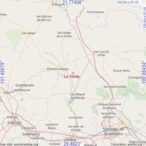
La Venta GPS coordinates[2]
21° 7' 10.668" North, 100° 47' 15.576" West
| Map corner | latitude | longitude |
|---|---|---|
| Upper-left | 21.77406°, | -101.49079° |
| Center: | 21.11963°, | -100.78766° |
| Lower-right: | 20.4623°, | -100.08454° |
| Map W x H: | 145.9×145.9 km | = 90.7×90.7mi |
| max Lat: | 32.7° ⇑21.8% North |
| La Venta: | 21.11963° |
| min Lat: | ⇓78.2% South 14.53588° |
| min Long | La Venta | max Long |
| -117.105° | -100.78766° | -86.73105° |
| W 28.2%⇐ | ⇒71.8% E |
Elevation
Elevation of La Venta is 1908 m = 6260 ft, and this is 654.3 m = 2147 ft above average elevation for this country.
| Max E: |
3497 m = 11473 ft | 31% |
| La Venta | 1908 m 6260 ft | |
| Avg. | 1253.7 m = 4113 ft | |
Min E: |
-1 m = -3 ft | 69% |
See also: Mexico elevation on elevation.city.
Geographical zone
La Venta is located in North Torrid zone (between Equator and Tropic of Cancer). Distance of this Northern Tropic circle is 257.6 km =160.1 mi to North.| Distance of | km | miles | from La Venta |
|---|---|---|---|
| North Pole | 7658.8 | 4759 | to North |
| Arctic Circle | 5052.9 | 3139.7 | to North |
| Tropic Cancer | 257.6 | 160.1 | to North |
| Equator | 2348.3 | 1459.2 | to South |


Nearby cities:
15 places around La Venta: (largest is in red/bold)
• Adjuntas del Río
8.3 km =5.2 mi,  267°
267°
• Ejido Jesús María
13.1 km =8.1 mi,  280°
280°
• Jamaica
6.1 km =3.8 mi,  64°
64°
• La Erre
13.4 km =8.3 mi,  260°
260°
• La Grulla
6.7 km =4.2 mi,  105°
105°
• La Palma
10.6 km =6.6 mi,  175°
175°
• Las Cañas
9.5 km =5.9 mi,  137°
137°
• Los Galvan
6.4 km =4 mi,  192°
192°
• Rancho Viejo
11.1 km =6.9 mi,  171°
171°
• San Gabriel
5 km =3.1 mi, 282°
• San Isidro de la Estacada
11.1 km =6.9 mi,  73°
73°
• San Pablo
11.5 km =7.1 mi, 56°
• Santa Clara
8 km =5 mi, 280°
• Sebastián
11.8 km =7.3 mi,  295°
295°
• Tequisquiapan
5.6 km =3.5 mi,  217°
217°
Sources, notices
• [Note1] Compared only with cities in Mexico existing in our database
• [Src1] Map data: © OpenStreetMap contributors (CC-BY-SA)
• [Src2] Other city data from geonames.org with taken over terms of usage.
• [Src3] Geographical zone / Annual Mean Temperature by Robert A. Rohde @ Wikipedia
