Coyamel (El Coyame) geodata
Coyamel (El Coyame) (Jalisco) is a populated place; located in Mexico in America/Mexico_City (GMT-6) time zone. With population of 528 people, there are 16014 cities with bigger population in this country. Compared to other cities in Mexico, 54.1% of cities are located further ↑North; 91% of cities are located further →East and 72.2% of cities have higher elevation than Coyamel (El Coyame). Note1


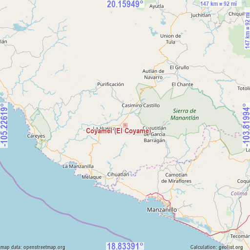
Coyamel (El Coyame) GPS coordinates[2]
19° 29' 53.016" North, 104° 31' 23.016" West
| Map corner | latitude | longitude |
|---|---|---|
| Upper-left | 20.15949°, | -105.22619° |
| Center: | 19.49806°, | -104.52306° |
| Lower-right: | 18.83391°, | -103.81994° |
| Map W x H: | 147.4×147.4 km | = 91.6×91.6mi |
| max Lat: | 32.7° ⇑54.1% North |
| Coyamel (El Coyame): | 19.49806° |
| min Lat: | ⇓45.9% South 14.53588° |
| min Long | Coyamel (El Coy | max Long |
| -117.105° | -104.52306° | -86.73105° |
| W 9%⇐ | ⇒91% E |
Elevation
Elevation of Coyamel (El Coyame) is 323 m = 1060 ft, and this is 930.7 m = 3053 ft below average elevation for this country.
| Max E: |
3497 m = 11473 ft | 72.2% |
| Avg. | 1253.7 m = 4113 ft | |
| Coyamel (El Coyame) | 323 m = 1060 ft | |
Min E: |
-1 m = -3 ft | 27.8% |
See also: Mexico elevation on elevation.city.
Geographical zone
Coyamel (El Coyame) is located in North Torrid zone (between Equator and Tropic of Cancer). Distance of this Northern Tropic circle is 437.9 km =272.1 mi to North.| Distance of | km | miles | from Coyamel (El Coyame) |
|---|---|---|---|
| North Pole | 7839.1 | 4871 | to North |
| Arctic Circle | 5233.2 | 3251.8 | to North |
| Tropic Cancer | 437.9 | 272.1 | to North |
| Equator | 2168 | 1347.1 | to South |


Nearby cities:
15 places around Coyamel (El Coyame): (largest is in red/bold)
• Ahuacapán
28.8 km =17.9 mi,  45°
45°
• Cihuatlán
29.4 km =18.3 mi,  188°
188°
• Cuautitlán
17.9 km =11.1 mi,  106°
106°
• Cuzalapa
21.7 km =13.5 mi,  90°
90°
• El Chico
8.2 km =5.1 mi,  333°
333°
• La Huerta
12.7 km =7.9 mi,  263°
263°
• La Resolana
15.1 km =9.4 mi,  37°
37°
• Las Juntas
20.6 km =12.8 mi,  248°
248°
• Lo Arado
13.8 km =8.6 mi,  355°
355°
• Piedra Pesada
7.6 km =4.7 mi, 39°
• Purificación
25.9 km =16.1 mi,  340°
340°
• San Miguel
29.4 km =18.3 mi,  313°
313°
• Tecomates
7 km =4.3 mi,  34°
34°
• Tequesquitlán
12.3 km =7.6 mi,  178°
178°
• Zapotillo
17.4 km =10.8 mi, 29°
Sources, notices
• [Note1] Compared only with cities in Mexico existing in our database
• [Src1] Map data: © OpenStreetMap contributors (CC-BY-SA)
• [Src2] Other city data from geonames.org with taken over terms of usage.
• [Src3] Geographical zone / Annual Mean Temperature by Robert A. Rohde @ Wikipedia
