El Chico geodata
El Chico (Jalisco) is a populated place; located in Mexico in America/Mexico_City (GMT-6) time zone. With population of 851 people, there are 10275 cities with bigger population in this country. Compared to other cities in Mexico, 52.8% of cities are located further ↑North; 91.1% of cities are located further →East and 72.9% of cities have higher elevation than El Chico. Note1


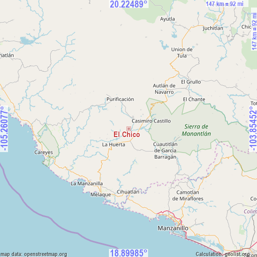
El Chico GPS coordinates[2]
19° 33' 49.428" North, 104° 33' 27.504" West
| Map corner | latitude | longitude |
|---|---|---|
| Upper-left | 20.22489°, | -105.26077° |
| Center: | 19.56373°, | -104.55764° |
| Lower-right: | 18.89985°, | -103.85452° |
| Map W x H: | 147.3×147.3 km | = 91.5×91.5mi |
| max Lat: | 32.7° ⇑52.8% North |
| El Chico: | 19.56373° |
| min Lat: | ⇓47.2% South 14.53588° |
| min Long | El Chico | max Long |
| -117.105° | -104.55764° | -86.73105° |
| W 8.9%⇐ | ⇒91.1% E |
Elevation
Elevation of El Chico is 291 m = 955 ft, and this is 962.7 m = 3158 ft below average elevation for this country.
| Max E: |
3497 m = 11473 ft | 72.9% |
| Avg. | 1253.7 m = 4113 ft | |
| El Chico | 291 m = 955 ft | |
Min E: |
-1 m = -3 ft | 27.1% |
See also: Mexico elevation on elevation.city.
Geographical zone
El Chico is located in North Torrid zone (between Equator and Tropic of Cancer). Distance of this Northern Tropic circle is 430.6 km =267.6 mi to North.| Distance of | km | miles | from El Chico |
|---|---|---|---|
| North Pole | 7831.8 | 4866.5 | to North |
| Arctic Circle | 5225.9 | 3247.2 | to North |
| Tropic Cancer | 430.6 | 267.6 | to North |
| Equator | 2175.3 | 1351.7 | to South |


Nearby cities:
15 places around El Chico: (largest is in red/bold)
• Ahuacapán
27.4 km =17 mi,  62°
62°
• Autlán de Navarro
30.3 km =18.8 mi,  41°
41°
• Coyamel (El Coyame)
8.2 km =5.1 mi,  153°
153°
• Cuautitlán
24.3 km =15.1 mi,  121°
121°
• Cuzalapa
26.4 km =16.4 mi,  106°
106°
• La Huerta
12.6 km =7.8 mi,  225°
225°
• La Resolana
13.7 km =8.5 mi,  70°
70°
• Las Juntas
21.5 km =13.4 mi, 226°
• Lo Arado
6.9 km =4.3 mi,  20°
20°
• Piedra Pesada
8.6 km =5.3 mi,  99°
99°
• Purificación
17.8 km =11.1 mi,  343°
343°
• San Miguel
22 km =13.7 mi,  305°
305°
• Tecomates
7.7 km =4.8 mi, 101°
• Tequesquitlán
20 km =12.4 mi,  168°
168°
• Zapotillo
14.5 km =9 mi, 57°
Sources, notices
• [Note1] Compared only with cities in Mexico existing in our database
• [Src1] Map data: © OpenStreetMap contributors (CC-BY-SA)
• [Src2] Other city data from geonames.org with taken over terms of usage.
• [Src3] Geographical zone / Annual Mean Temperature by Robert A. Rohde @ Wikipedia
