Las Cruces geodata
Las Cruces (Guanajuato) is a populated place; located in Mexico in America/Mexico_City (GMT-6) time zone. With population of 791 people, there are 11037 cities with bigger population in this country. Compared to other cities in Mexico, 59.2% of cities are located further ↓South; 73.3% of cities are located further →East and 79.4% of cities have lower elevation than Las Cruces. Note1


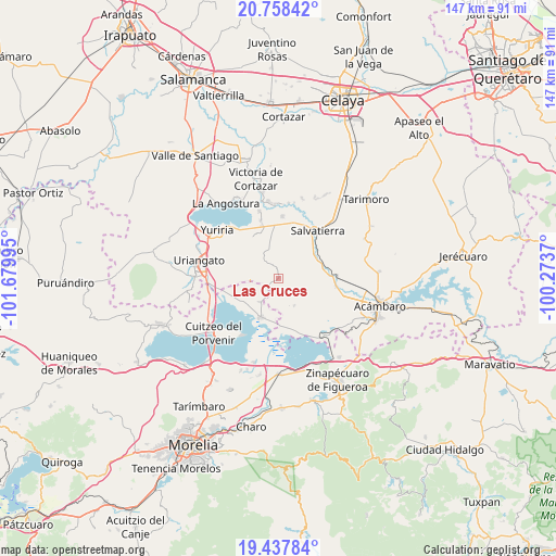
Las Cruces GPS coordinates[2]
20° 5' 58.272" North, 100° 58' 36.552" West
| Map corner | latitude | longitude |
|---|---|---|
| Upper-left | 20.75842°, | -101.67995° |
| Center: | 20.09952°, | -100.97682° |
| Lower-right: | 19.43784°, | -100.2737° |
| Map W x H: | 146.8×146.8 km | = 91.2×91.2mi |
| max Lat: | 32.7° ⇑40.8% North |
| Las Cruces: | 20.09952° |
| min Lat: | ⇓59.2% South 14.53588° |
| min Long | Las Cruces | max Long |
| -117.105° | -100.97682° | -86.73105° |
| W 26.7%⇐ | ⇒73.3% E |
Elevation
Elevation of Las Cruces is 2126 m = 6975 ft, and this is 872.3 m = 2862 ft above average elevation for this country.
| Max E: |
3497 m = 11473 ft | 20.6% |
| Las Cruces | 2126 m 6975 ft | |
| Avg. | 1253.7 m = 4113 ft | |
Min E: |
-1 m = -3 ft | 79.4% |
See also: Mexico elevation on elevation.city.
Geographical zone
Las Cruces is located in North Torrid zone (between Equator and Tropic of Cancer). Distance of this Northern Tropic circle is 371.1 km =230.6 mi to North.| Distance of | km | miles | from Las Cruces |
|---|---|---|---|
| North Pole | 7772.2 | 4829.4 | to North |
| Arctic Circle | 5166.3 | 3210.2 | to North |
| Tropic Cancer | 371.1 | 230.6 | to North |
| Equator | 2234.9 | 1388.7 | to South |


Nearby cities:
15 places around Las Cruces: (largest is in red/bold)
• El Salteador
11.4 km =7.1 mi,  292°
292°
• El Timbinal
7.5 km =4.7 mi,  265°
265°
• Estancia del Carmen de Maravatío
6 km =3.7 mi,  79°
79°
• Huacao
7.9 km =4.9 mi,  217°
217°
• La Lobera
11.3 km =7 mi,  234°
234°
• La Palma de Eménguaro
9.7 km =6 mi,  60°
60°
• La Virgen
8.9 km =5.5 mi, 57°
• Maravatío del Encinal
11.8 km =7.3 mi,  7°
7°
• San Antonio Eménguaro
11.2 km =7 mi,  66°
66°
• San Miguel Eménguaro
11.9 km =7.4 mi,  52°
52°
• San Pablo Pejo
8.4 km =5.2 mi,  150°
150°
• Santa Ana Maya
11.3 km =7 mi,  204°
204°
• Santa Rita de Casia
11 km =6.8 mi,  354°
354°
• Santa Teresa (La Majada)
9.6 km =6 mi, 10°
• Santiago Maravatío
8.4 km =5.2 mi, 347°
Sources, notices
• [Note1] Compared only with cities in Mexico existing in our database
• [Src1] Map data: © OpenStreetMap contributors (CC-BY-SA)
• [Src2] Other city data from geonames.org with taken over terms of usage.
• [Src3] Geographical zone / Annual Mean Temperature by Robert A. Rohde @ Wikipedia
