Jucutacato geodata
Jucutacato (Michoacán) is a populated place; located in Mexico in America/Mexico_City (GMT-6) time zone. With population of 1,442 people, there are 5987 cities with bigger population in this country. Compared to other cities in Mexico, 56.8% of cities are located further ↑North; 81.4% of cities are located further →East and 55.5% of cities have lower elevation than Jucutacato. Note1


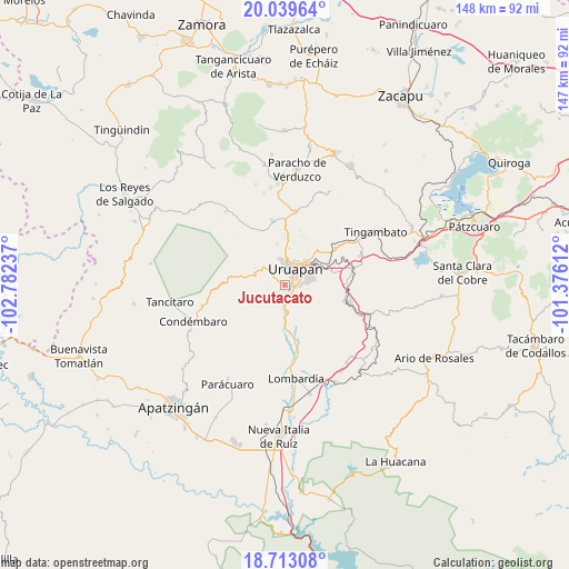
Jucutacato GPS coordinates[2]
19° 22' 39.756" North, 102° 4' 45.264" West
| Map corner | latitude | longitude |
|---|---|---|
| Upper-left | 20.03964°, | -102.78237° |
| Center: | 19.37771°, | -102.07924° |
| Lower-right: | 18.71308°, | -101.37612° |
| Map W x H: | 147.5×147.5 km | = 91.7×91.7mi |
| max Lat: | 32.7° ⇑56.8% North |
| Jucutacato: | 19.37771° |
| min Lat: | ⇓43.2% South 14.53588° |
| min Long | Jucutacato | max Long |
| -117.105° | -102.07924° | -86.73105° |
| W 18.6%⇐ | ⇒81.4% E |
Elevation
Elevation of Jucutacato is 1603 m = 5259 ft, and this is 349.3 m = 1146 ft above average elevation for this country.
| Max E: |
3497 m = 11473 ft | 44.5% |
| Jucutacato | 1603 m 5259 ft | |
| Avg. | 1253.7 m = 4113 ft | |
Min E: |
-1 m = -3 ft | 55.5% |
See also: Mexico elevation on elevation.city.
Geographical zone
Jucutacato is located in North Torrid zone (between Equator and Tropic of Cancer). Distance of this Northern Tropic circle is 451.3 km =280.4 mi to North.| Distance of | km | miles | from Jucutacato |
|---|---|---|---|
| North Pole | 7852.5 | 4879.3 | to North |
| Arctic Circle | 5246.6 | 3260.1 | to North |
| Tropic Cancer | 451.3 | 280.4 | to North |
| Equator | 2154.6 | 1338.8 | to South |


Nearby cities:
15 places around Jucutacato: (largest is in red/bold)
• Arandín
5.1 km =3.2 mi,  301°
301°
• Caltzontzín
9.1 km =5.7 mi,  56°
56°
• Charapendo
12.7 km =7.9 mi,  173°
173°
• Cutzato (Cuisato)
6 km =3.7 mi,  257°
257°
• El Arroyo Colorado
4 km =2.5 mi,  141°
141°
• El Sabino
14.8 km =9.2 mi,  130°
130°
• Emiliano Zapata
15.7 km =9.8 mi,  106°
106°
• La Basília
9.6 km =6 mi,  8°
8°
• Nuevo San Juan Parangaricutiro
7.1 km =4.4 mi,  309°
309°
• San Lorenzo
17 km =10.6 mi,  349°
349°
• Santa Rosa (Santa Bárbara)
4.6 km =2.9 mi,  82°
82°
• Tahuejo
14.2 km =8.8 mi,  117°
117°
• Toreo Bajo (El Toreo Bajo)
10.8 km =6.7 mi,  46°
46°
• Uruapan
4.4 km =2.7 mi,  32°
32°
• Zirimícuaro
13.1 km =8.1 mi, 75°
Sources, notices
• [Note1] Compared only with cities in Mexico existing in our database
• [Src1] Map data: © OpenStreetMap contributors (CC-BY-SA)
• [Src2] Other city data from geonames.org with taken over terms of usage.
• [Src3] Geographical zone / Annual Mean Temperature by Robert A. Rohde @ Wikipedia
