Cutzato (Cuisato) geodata
Cutzato (Cuisato) (Michoacán) is a populated place; located in Mexico in America/Mexico_City (GMT-6) time zone. With population of 878 people, there are 9946 cities with bigger population in this country. Compared to other cities in Mexico, 57.2% of cities are located further ↑North; 81.7% of cities are located further →East and 61% of cities have lower elevation than Cutzato (Cuisato). Note1


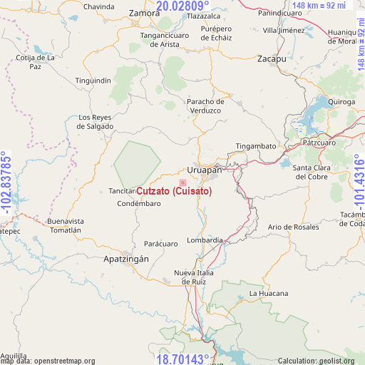
Cutzato (Cuisato) GPS coordinates[2]
19° 21' 57.996" North, 102° 8' 4.992" West
| Map corner | latitude | longitude |
|---|---|---|
| Upper-left | 20.02809°, | -102.83785° |
| Center: | 19.36611°, | -102.13472° |
| Lower-right: | 18.70143°, | -101.4316° |
| Map W x H: | 147.5×147.5 km | = 91.7×91.7mi |
| max Lat: | 32.7° ⇑57.2% North |
| Cutzato (Cuisato): | 19.36611° |
| min Lat: | ⇓42.8% South 14.53588° |
| min Long | Cutzato (Cuisat | max Long |
| -117.105° | -102.13472° | -86.73105° |
| W 18.3%⇐ | ⇒81.7% E |
Elevation
Elevation of Cutzato (Cuisato) is 1743 m = 5719 ft, and this is 489.3 m = 1605 ft above average elevation for this country.
| Max E: |
3497 m = 11473 ft | 39% |
| Cutzato (Cuisato) | 1743 m 5719 ft | |
| Avg. | 1253.7 m = 4113 ft | |
Min E: |
-1 m = -3 ft | 61% |
See also: Mexico elevation on elevation.city.
Geographical zone
Cutzato (Cuisato) is located in North Torrid zone (between Equator and Tropic of Cancer). Distance of this Northern Tropic circle is 452.6 km =281.2 mi to North.| Distance of | km | miles | from Cutzato (Cuisato) |
|---|---|---|---|
| North Pole | 7853.8 | 4880.1 | to North |
| Arctic Circle | 5247.9 | 3260.9 | to North |
| Tropic Cancer | 452.6 | 281.2 | to North |
| Equator | 2153.3 | 1338 | to South |


Nearby cities:
15 places around Cutzato (Cuisato): (largest is in red/bold)
• Arandín
4.3 km =2.7 mi,  20°
20°
• Araparícuaro (Aparícuaro)
16.2 km =10.1 mi,  254°
254°
• Caltzontzín
14.9 km =9.3 mi,  64°
64°
• Charapendo
13.5 km =8.4 mi,  147°
147°
• El Arroyo Colorado
8.5 km =5.3 mi,  102°
102°
• El Sabino
19 km =11.8 mi,  115°
115°
• Jucutacato
6 km =3.7 mi,  77°
77°
• La Basília
12.9 km =8 mi,  33°
33°
• La Estancia
17.9 km =11.1 mi,  194°
194°
• Nuevo San Juan Parangaricutiro
5.8 km =3.6 mi,  3°
3°
• San Lorenzo
18.2 km =11.3 mi,  8°
8°
• Santa Rosa (Santa Bárbara)
10.5 km =6.5 mi, 79°
• Toreo Bajo (El Toreo Bajo)
16.2 km =10.1 mi, 57°
• Uruapan
9.6 km =6 mi, 58°
• Zirimícuaro
19.1 km =11.9 mi, 75°
Sources, notices
• [Note1] Compared only with cities in Mexico existing in our database
• [Src1] Map data: © OpenStreetMap contributors (CC-BY-SA)
• [Src2] Other city data from geonames.org with taken over terms of usage.
• [Src3] Geographical zone / Annual Mean Temperature by Robert A. Rohde @ Wikipedia
