Juárez geodata
Juárez (Chihuahua) is a populated place; located in Mexico in America/Chihuahua (GMT-6) time zone. With population of 1,035 people, there are 8423 cities with bigger population in this country. Compared to other cities in Mexico, 98.6% of cities are located further ↓South; 95.7% of cities are located further →East and 52.7% of cities have lower elevation than Juárez. Note1


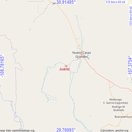
Juárez GPS coordinates[2]
30° 18' 35.352" North, 108° 4' 42.672" West
| Map corner | latitude | longitude |
|---|---|---|
| Upper-left | 30.91495°, | -108.78165° |
| Center: | 30.30982°, | -108.07852° |
| Lower-right: | 29.70093°, | -107.3754° |
| Map W x H: | 135×135 km | = 83.9×83.9mi |
| max Lat: | 32.7° ⇑1.4% North |
| Juárez: | 30.30982° |
| min Lat: | ⇓98.6% South 14.53588° |
| min Long | Juárez | max Long |
| -117.105° | -108.07852° | -86.73105° |
| W 4.3%⇐ | ⇒95.7% E |
Elevation
Elevation of Juárez is 1536 m = 5039 ft, and this is 282.3 m = 926 ft above average elevation for this country.
| Max E: |
3497 m = 11473 ft | 47.3% |
| Juárez | 1536 m 5039 ft | |
| Avg. | 1253.7 m = 4113 ft | |
Min E: |
-1 m = -3 ft | 52.7% |
See also: Mexico elevation on elevation.city.
Geographical zone
Juárez is located in North temperate zone (between Tropic of Cancer and the Arctic Circle). Distance of this Northern Tropic circle is 764.2 km =474.9 mi to South.| Distance of | km | miles | from Juárez |
|---|---|---|---|
| North Pole | 6636.9 | 4124 | to North |
| Arctic Circle | 4031 | 2504.7 | to North |
| Tropic Cancer | 764.2 | 474.9 | to South |
| Equator | 3370.1 | 2094.1 | to South |


Nearby cities:
15 places around Juárez: (largest is in red/bold)
• Abdenago C. García
61.9 km =38.5 mi,  125°
125°
• Benito Juárez
64.1 km =39.8 mi,  167°
167°
• Buena Fe
16 km =9.9 mi,  67°
67°
• Casas Grandes
14.3 km =8.9 mi,  55°
55°
• Colonia el Valle
75.2 km =46.7 mi,  108°
108°
• Ejido El Largo
72 km =44.7 mi,  194°
194°
• Fernández Leal
63.3 km =39.3 mi,  341°
341°
• Francisco I. Madero
72.1 km =44.8 mi,  158°
158°
• Galeana
49.5 km =30.8 mi,  116°
116°
• Hermenegildo Galeana
49.5 km =30.8 mi, 116°
• Janos
65.4 km =40.6 mi,  350°
350°
• Mesa del Huracán
73 km =45.4 mi, 193°
• Nuevo Casas Grandes
19.9 km =12.4 mi,  53°
53°
• Rodrígo M. Quevedo
69 km =42.9 mi, 128°
• Tres Álamos
60.9 km =37.8 mi, 339°
Sources, notices
• [Note1] Compared only with cities in Mexico existing in our database
• [Src1] Map data: © OpenStreetMap contributors (CC-BY-SA)
• [Src2] Other city data from geonames.org with taken over terms of usage.
• [Src3] Geographical zone / Annual Mean Temperature by Robert A. Rohde @ Wikipedia
