Fernández Leal geodata
Fernández Leal (Chihuahua) is a populated place; located in Mexico in America/Chihuahua (GMT-6) time zone. With population of 885 people, there are 9853 cities with bigger population in this country. Compared to other cities in Mexico, 98.9% of cities are located further ↓South; 95.9% of cities are located further →East and 50.9% of cities have higher elevation than Fernández Leal. Note1


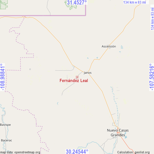
Fernández Leal GPS coordinates[2]
30° 51' 3.492" North, 108° 17' 7.008" West
| Map corner | latitude | longitude |
|---|---|---|
| Upper-left | 31.4527°, | -108.98841° |
| Center: | 30.85097°, | -108.28528° |
| Lower-right: | 30.24544°, | -107.58216° |
| Map W x H: | 134.2×134.2 km | = 83.4×83.4mi |
| max Lat: | 32.7° ⇑1.1% North |
| Fernández Leal: | 30.85097° |
| min Lat: | ⇓98.9% South 14.53588° |
| min Long | Fernández Leal | max Long |
| -117.105° | -108.28528° | -86.73105° |
| W 4.1%⇐ | ⇒95.9% E |
Elevation
Elevation of Fernández Leal is 1387 m = 4551 ft, and this is 133.3 m = 437 ft above average elevation for this country.
| Max E: |
3497 m = 11473 ft | 50.9% |
| Fernández Leal | 1387 m 4551 ft | |
| Avg. | 1253.7 m = 4113 ft | |
Min E: |
-1 m = -3 ft | 49.1% |
See also: Mexico elevation on elevation.city.
Geographical zone
Fernández Leal is located in North temperate zone (between Tropic of Cancer and the Arctic Circle). Distance of this Northern Tropic circle is 824.4 km =512.3 mi to South.| Distance of | km | miles | from Fernández Leal |
|---|---|---|---|
| North Pole | 6576.8 | 4086.6 | to North |
| Arctic Circle | 3970.9 | 2467.4 | to North |
| Tropic Cancer | 824.4 | 512.3 | to South |
| Equator | 3430.3 | 2131.5 | to South |


Nearby cities:
15 places around Fernández Leal: (largest is in red/bold)
• Ascención
39.9 km =24.8 mi,  46°
46°
• Ascensión
38.4 km =23.9 mi, 45°
• Bacerac
82.8 km =51.4 mi,  228°
228°
• Bavispe
75 km =46.6 mi,  236°
236°
• Buena Fe
64.2 km =39.9 mi,  147°
147°
• Casas Grandes
60.8 km =37.8 mi, 148°
• El Bismarck
79.3 km =49.3 mi,  58°
58°
• Entronque (Ley Seis de Enero)
94.1 km =58.5 mi,  43°
43°
• Guadalupe Victoria
92.1 km =57.2 mi,  34°
34°
• Janos
9.7 km =6 mi, 63°
• Juárez
63.3 km =39.3 mi,  161°
161°
• Monte Verde
41.7 km =25.9 mi,  279°
279°
• Nuevo Casas Grandes
60.2 km =37.4 mi,  143°
143°
• Pancho Villa
34.8 km =21.6 mi,  261°
261°
• Tres Álamos
3.3 km =2.1 mi,  203°
203°
Sources, notices
• [Note1] Compared only with cities in Mexico existing in our database
• [Src1] Map data: © OpenStreetMap contributors (CC-BY-SA)
• [Src2] Other city data from geonames.org with taken over terms of usage.
• [Src3] Geographical zone / Annual Mean Temperature by Robert A. Rohde @ Wikipedia
