Casas Grandes geodata
Casas Grandes (Chihuahua) is a seat of a second-order administrative division; located in Mexico in America/Chihuahua (GMT-6) time zone. With population of 5,256 people, there are 1763 cities with bigger population in this country. Compared to other cities in Mexico, 98.6% of cities are located further ↓South; 95.6% of cities are located further →East and 50.8% of cities have lower elevation than Casas Grandes. Note1


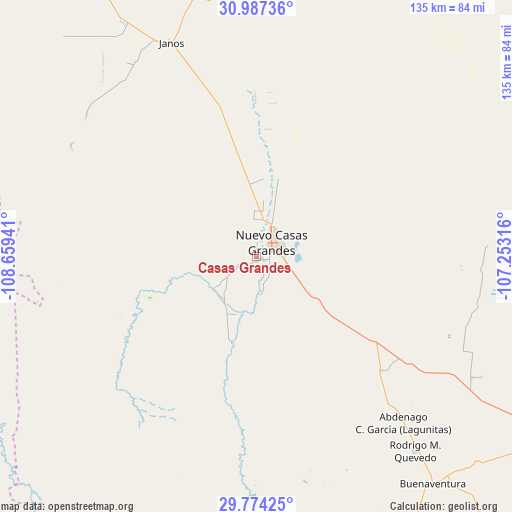
Casas Grandes GPS coordinates[2]
30° 22' 57.684" North, 107° 57' 22.608" West
| Map corner | latitude | longitude |
|---|---|---|
| Upper-left | 30.98736°, | -108.65941° |
| Center: | 30.38269°, | -107.95628° |
| Lower-right: | 29.77425°, | -107.25316° |
| Map W x H: | 134.9×134.9 km | = 83.8×83.8mi |
| max Lat: | 32.7° ⇑1.4% North |
| Casas Grandes: | 30.38269° |
| min Lat: | ⇓98.6% South 14.53588° |
| min Long | Casas Grandes | max Long |
| -117.105° | -107.95628° | -86.73105° |
| W 4.4%⇐ | ⇒95.6% E |
Elevation
Elevation of Casas Grandes is 1476 m = 4843 ft, and this is 222.3 m = 729 ft above average elevation for this country.
| Max E: |
3497 m = 11473 ft | 49.2% |
| Casas Grandes | 1476 m 4843 ft | |
| Avg. | 1253.7 m = 4113 ft | |
Min E: |
-1 m = -3 ft | 50.8% |
See also: Mexico elevation on elevation.city.
Geographical zone
Casas Grandes is located in North temperate zone (between Tropic of Cancer and the Arctic Circle). Distance of this Northern Tropic circle is 772.3 km =479.9 mi to South.| Distance of | km | miles | from Casas Grandes |
|---|---|---|---|
| North Pole | 6628.8 | 4118.9 | to North |
| Arctic Circle | 4022.9 | 2499.7 | to North |
| Tropic Cancer | 772.3 | 479.9 | to South |
| Equator | 3378.2 | 2099.1 | to South |


Nearby cities:
15 places around Casas Grandes: (largest is in red/bold)
• Abdenago C. García
58.5 km =36.4 mi,  138°
138°
• Ascensión
79 km =49.1 mi,  357°
357°
• Benito Juárez
70.8 km =44 mi,  178°
178°
• Buena Fe
3.7 km =2.3 mi,  123°
123°
• Colonia el Valle
67.5 km =41.9 mi, 117°
• Fernández Leal
60.8 km =37.8 mi,  328°
328°
• Francisco I. Madero
76.6 km =47.6 mi,  169°
169°
• Galeana
44.3 km =27.5 mi,  132°
132°
• Hermenegildo Galeana
44.4 km =27.6 mi, 132°
• Janos
60.7 km =37.7 mi,  337°
337°
• Juárez
14.3 km =8.9 mi,  235°
235°
• Nuevo Casas Grandes
5.6 km =3.5 mi,  49°
49°
• Rodrígo M. Quevedo
66.3 km =41.2 mi, 140°
• San Buenaventura
76.6 km =47.6 mi, 141°
• Tres Álamos
59 km =36.7 mi, 326°
Sources, notices
• [Note1] Compared only with cities in Mexico existing in our database
• [Src1] Map data: © OpenStreetMap contributors (CC-BY-SA)
• [Src2] Other city data from geonames.org with taken over terms of usage.
• [Src3] Geographical zone / Annual Mean Temperature by Robert A. Rohde @ Wikipedia
