Galeana geodata
Galeana (Chihuahua) is a seat of a second-order administrative division; located in Mexico in America/Chihuahua (GMT-6) time zone. In our database, there are 16903 cities with bigger population. Compared to other cities in Mexico, 98.5% of cities are located further ↓South; 95.1% of cities are located further →East and 50% of cities have lower elevation than Galeana. Note1


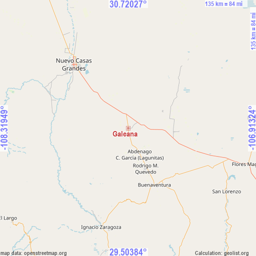
Galeana GPS coordinates[2]
30° 6' 50.148" North, 107° 36' 58.896" West
| Map corner | latitude | longitude |
|---|---|---|
| Upper-left | 30.72027°, | -108.31949° |
| Center: | 30.11393°, | -107.61636° |
| Lower-right: | 29.50384°, | -106.91324° |
| Map W x H: | 135.3×135.3 km | = 84.1×84.1mi |
| max Lat: | 32.7° ⇑1.5% North |
| Galeana: | 30.11393° |
| min Lat: | ⇓98.5% South 14.53588° |
| min Long | Galeana | max Long |
| -117.105° | -107.61636° | -86.73105° |
| W 4.9%⇐ | ⇒95.1% E |
Elevation
Elevation of Galeana is 1430 m = 4692 ft, and this is 176.3 m = 578 ft above average elevation for this country.
| Max E: |
3497 m = 11473 ft | 50% |
| Galeana | 1430 m 4692 ft | |
| Avg. | 1253.7 m = 4113 ft | |
Min E: |
-1 m = -3 ft | 50% |
See also: Mexico elevation on elevation.city.
Geographical zone
Galeana is located in North temperate zone (between Tropic of Cancer and the Arctic Circle). Distance of this Northern Tropic circle is 742.4 km =461.3 mi to South.| Distance of | km | miles | from Galeana |
|---|---|---|---|
| North Pole | 6658.7 | 4137.5 | to North |
| Arctic Circle | 4052.8 | 2518.3 | to North |
| Tropic Cancer | 742.4 | 461.3 | to South |
| Equator | 3348.4 | 2080.6 | to South |


Nearby cities:
15 places around Galeana: (largest is in red/bold)
• Abdenago C. García
15.2 km =9.4 mi,  155°
155°
• Benito Juárez
51.4 km =31.9 mi,  217°
217°
• Buena Fe
40.6 km =25.2 mi,  313°
313°
• Casas Grandes
44.3 km =27.5 mi, 312°
• Colonia el Valle
27.1 km =16.8 mi,  93°
93°
• Ejido Benito Juárez
70.6 km =43.9 mi, 86°
• Francisco I. Madero
48.8 km =30.3 mi,  201°
201°
• Hermenegildo Galeana
0.1 km =0.1 mi,  169°
169°
• Ignacio Allende
59 km =36.7 mi,  190°
190°
• Ignacio Zaragoza
54.3 km =33.7 mi, 195°
• Juárez
49.5 km =30.8 mi,  296°
296°
• Nuevo Casas Grandes
43.9 km =27.3 mi,  319°
319°
• Rodrígo M. Quevedo
23.5 km =14.6 mi, 156°
• San Buenaventura
33.6 km =20.9 mi,  153°
153°
• San Lorenzo
61.8 km =38.4 mi,  122°
122°
Sources, notices
• [Note1] Compared only with cities in Mexico existing in our database
• [Src1] Map data: © OpenStreetMap contributors (CC-BY-SA)
• [Src2] Other city data from geonames.org with taken over terms of usage.
• [Src3] Geographical zone / Annual Mean Temperature by Robert A. Rohde @ Wikipedia
