Allende geodata
Allende (Jalisco) is a populated place; located in Mexico in America/Mexico_City (GMT-6) time zone. With population of 1,618 people, there are 5348 cities with bigger population in this country. Compared to other cities in Mexico, 72% of cities are located further ↓South; 81.4% of cities are located further →East and 85.3% of cities have lower elevation than Allende. Note1


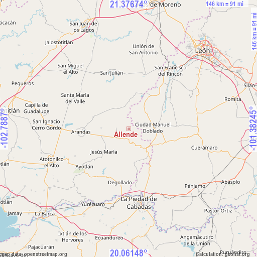
Allende GPS coordinates[2]
20° 43' 13.944" North, 102° 5' 8.052" West
| Map corner | latitude | longitude |
|---|---|---|
| Upper-left | 21.37674°, | -102.7887° |
| Center: | 20.72054°, | -102.08557° |
| Lower-right: | 20.06148°, | -101.38245° |
| Map W x H: | 146.2×146.2 km | = 90.8×90.8mi |
| max Lat: | 32.7° ⇑28% North |
| Allende: | 20.72054° |
| min Lat: | ⇓72% South 14.53588° |
| min Long | Allende | max Long |
| -117.105° | -102.08557° | -86.73105° |
| W 18.6%⇐ | ⇒81.4% E |
Elevation
Elevation of Allende is 2264 m = 7428 ft, and this is 1010.3 m = 3315 ft above average elevation for this country.
| Max E: |
3497 m = 11473 ft | 14.7% |
| Allende | 2264 m 7428 ft | |
| Avg. | 1253.7 m = 4113 ft | |
Min E: |
-1 m = -3 ft | 85.3% |
See also: Mexico elevation on elevation.city.
Geographical zone
Allende is located in North Torrid zone (between Equator and Tropic of Cancer). Distance of this Northern Tropic circle is 302 km =187.7 mi to North.| Distance of | km | miles | from Allende |
|---|---|---|---|
| North Pole | 7703.2 | 4786.5 | to North |
| Arctic Circle | 5097.3 | 3167.3 | to North |
| Tropic Cancer | 302 | 187.7 | to North |
| Equator | 2303.9 | 1431.6 | to South |


Nearby cities:
15 places around Allende: (largest is in red/bold)
• Calzada del Tepozán
21.2 km =13.2 mi,  84°
84°
• Ciudad Manuel Doblado
13.9 km =8.6 mi,  86°
86°
• El Charcón
18.2 km =11.3 mi, 84°
• El Toro
22.1 km =13.7 mi,  57°
57°
• Frías
12.8 km =8 mi,  46°
46°
• Guadalupe de Jalpa
19.1 km =11.9 mi,  35°
35°
• Guayabo de Santa Rita
19 km =11.8 mi,  97°
97°
• Jalpa de Cánovas
20.7 km =12.9 mi,  30°
30°
• Jesús María
19.1 km =11.9 mi,  228°
228°
• La Ladera
10.7 km =6.6 mi,  65°
65°
• Los Robles
20.3 km =12.6 mi, 229°
• Maravillas
18.9 km =11.7 mi, 81°
• Rancho Nuevo de Atotonilquillo
20.4 km =12.7 mi, 104°
• San José de la Paz
19.1 km =11.9 mi,  171°
171°
• Santiaguito (Santiaguito de Velázquez)
15.8 km =9.8 mi,  271°
271°
Sources, notices
• [Note1] Compared only with cities in Mexico existing in our database
• [Src1] Map data: © OpenStreetMap contributors (CC-BY-SA)
• [Src2] Other city data from geonames.org with taken over terms of usage.
• [Src3] Geographical zone / Annual Mean Temperature by Robert A. Rohde @ Wikipedia
