Los Robles geodata
Los Robles (Jalisco) is a populated place; located in Mexico in America/Mexico_City (GMT-6) time zone. With population of 693 people, there are 12564 cities with bigger population in this country. Compared to other cities in Mexico, 70% of cities are located further ↓South; 82.2% of cities are located further →East and 76.2% of cities have lower elevation than Los Robles. Note1


Los Robles GPS coordinates[2]
20° 36' 7.992" North, 102° 14' 3.984" West
| Map corner | latitude | longitude |
|---|---|---|
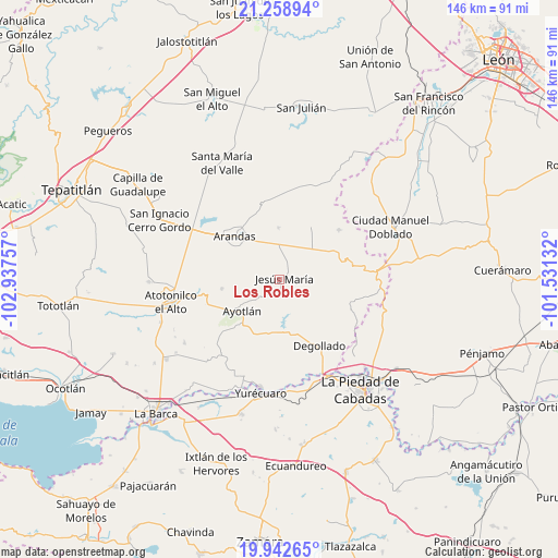
| Upper-left | 21.25894°, | -102.93757° |
| Center: | 20.60222°, | -102.23444° |
| Lower-right: | 19.94265°, | -101.53132° |
| Map W x H: | 146.4×146.4 km | = 91×91mi |
| max Lat: | 32.7° ⇑30% North |
| Los Robles: | 20.60222° |
| min Lat: | ⇓70% South 14.53588° |
| min Long | Los Robles | max Long |
| -117.105° | -102.23444° | -86.73105° |
| W 17.8%⇐ | ⇒82.2% E |
Elevation
Elevation of Los Robles is 2051 m = 6729 ft, and this is 797.3 m = 2616 ft above average elevation for this country.
| Max E: |
3497 m = 11473 ft | 23.8% |
| Los Robles | 2051 m 6729 ft | |
| Avg. | 1253.7 m = 4113 ft | |
Min E: |
-1 m = -3 ft | 76.2% |
See also: Mexico elevation on elevation.city.
Geographical zone
Los Robles is located in North Torrid zone (between Equator and Tropic of Cancer). Distance of this Northern Tropic circle is 315.2 km =195.9 mi to North.| Distance of | km | miles | from Los Robles |
|---|---|---|---|
| North Pole | 7716.3 | 4794.7 | to North |
| Arctic Circle | 5110.4 | 3175.5 | to North |
| Tropic Cancer | 315.2 | 195.9 | to North |
| Equator | 2290.8 | 1423.4 | to South |


Nearby cities:
15 places around Los Robles: (largest is in red/bold)
• Allende
20.3 km =12.6 mi,  49°
49°
• Arandas
16.3 km =10.1 mi,  314°
314°
• Ayotlán
12.5 km =7.8 mi,  229°
229°
• Betania
15.2 km =9.4 mi,  261°
261°
• Cañada de San Ignacio
13.6 km =8.5 mi,  245°
245°
• Degollado
17.4 km =10.8 mi,  149°
149°
• El Maluco
17.2 km =10.7 mi,  204°
204°
• Huáscato
13.7 km =8.5 mi,  185°
185°
• Jesús María
1.3 km =0.8 mi,  71°
71°
• La Isla
17.5 km =10.9 mi,  223°
223°
• La Palma (La Angostura)
19.9 km =12.4 mi, 259°
• Mirandillas
20.3 km =12.6 mi,  238°
238°
• Rinconada de los Vázquez [Fraccionamiento]
18.9 km =11.7 mi, 310°
• San José de la Paz
19.2 km =11.9 mi,  107°
107°
• Santiaguito (Santiaguito de Velázquez)
13.7 km =8.5 mi,  358°
358°
Sources, notices
• [Note1] Compared only with cities in Mexico existing in our database
• [Src1] Map data: © OpenStreetMap contributors (CC-BY-SA)
• [Src2] Other city data from geonames.org with taken over terms of usage.
• [Src3] Geographical zone / Annual Mean Temperature by Robert A. Rohde @ Wikipedia
