Jalostotitlán geodata
Jalostotitlán (Jalisco) is a seat of a second-order administrative division; located in Mexico in America/Mexico_City (GMT-6) time zone. With population of 24,423 people, there are 415 cities with bigger population in this country. Compared to other cities in Mexico, 78.8% of cities are located further ↓South; 83.8% of cities are located further →East and 62.2% of cities have lower elevation than Jalostotitlán. Note1


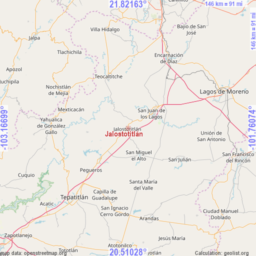
Jalostotitlán GPS coordinates[2]
21° 10' 2.676" North, 102° 27' 49.896" West
| Map corner | latitude | longitude |
|---|---|---|
| Upper-left | 21.82163°, | -103.16699° |
| Center: | 21.16741°, | -102.46386° |
| Lower-right: | 20.51028°, | -101.76074° |
| Map W x H: | 145.8×145.8 km | = 90.6×90.6mi |
| max Lat: | 32.7° ⇑21.2% North |
| Jalostotitlán: | 21.16741° |
| min Lat: | ⇓78.8% South 14.53588° |
| min Long | Jalostotitlán | max Long |
| -117.105° | -102.46386° | -86.73105° |
| W 16.2%⇐ | ⇒83.8% E |
Elevation
Elevation of Jalostotitlán is 1763 m = 5784 ft, and this is 509.3 m = 1671 ft above average elevation for this country.
| Max E: |
3497 m = 11473 ft | 37.8% |
| Jalostotitlán | 1763 m 5784 ft | |
| Avg. | 1253.7 m = 4113 ft | |
Min E: |
-1 m = -3 ft | 62.2% |
See also: Mexico elevation on elevation.city.
Geographical zone
Jalostotitlán is located in North Torrid zone (between Equator and Tropic of Cancer). Distance of this Northern Tropic circle is 252.3 km =156.8 mi to North.| Distance of | km | miles | from Jalostotitlán |
|---|---|---|---|
| North Pole | 7653.5 | 4755.7 | to North |
| Arctic Circle | 5047.6 | 3136.4 | to North |
| Tropic Cancer | 252.3 | 156.8 | to North |
| Equator | 2353.6 | 1462.5 | to South |


Nearby cities:
15 places around Jalostotitlán: (largest is in red/bold)
• Cañadas de Obregón
23.3 km =14.5 mi,  265°
265°
• Colonia Santa Cecilia (La Sauceda)
15 km =9.3 mi,  50°
50°
• Colonia Veintitrés de Mayo
32.7 km =20.3 mi,  122°
122°
• Huejotitlán
30.7 km =19.1 mi,  324°
324°
• La Calera [Fraccionamiento]
17.3 km =10.7 mi, 49°
• Mezquitic de la Magdalena
17.6 km =10.9 mi,  70°
70°
• Pegueros
31.8 km =19.8 mi,  221°
221°
• San Gaspar de los Reyes
14.3 km =8.9 mi,  343°
343°
• San José de los Reynoso
21.4 km =13.3 mi, 119°
• San Juan de los Lagos
16.5 km =10.3 mi,  56°
56°
• San Miguel el Alto
16.5 km =10.3 mi,  157°
157°
• Solidaridad [Fraccionamiento]
1.3 km =0.8 mi,  299°
299°
• Teocaltiche
31.8 km =19.8 mi, 338°
• Teocaltitan
7.4 km =4.6 mi,  112°
112°
• Valle de Guadalupe
23.5 km =14.6 mi, 222°
Sources, notices
• [Note1] Compared only with cities in Mexico existing in our database
• [Src1] Map data: © OpenStreetMap contributors (CC-BY-SA)
• [Src2] Other city data from geonames.org with taken over terms of usage.
• [Src3] Geographical zone / Annual Mean Temperature by Robert A. Rohde @ Wikipedia
