Camajoa geodata
Camajoa (Sinaloa) is a populated place; located in Mexico in America/Mazatlan (GMT-7) time zone. With population of 755 people, there are 11595 cities with bigger population in this country. Compared to other cities in Mexico, 95.3% of cities are located further ↓South; 96.8% of cities are located further →East and 88.3% of cities have higher elevation than Camajoa. Note1


Camajoa GPS coordinates[2]
25° 59' 17.016" North, 108° 51' 21.996" West
| Map corner | latitude | longitude |
|---|---|---|
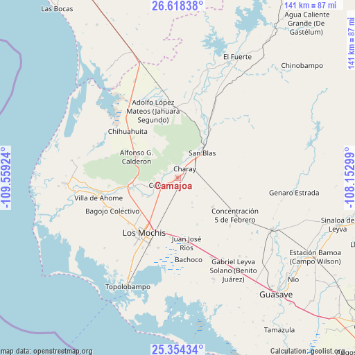
| Upper-left | 26.61838°, | -109.55924° |
| Center: | 25.98806°, | -108.85611° |
| Lower-right: | 25.35434°, | -108.15299° |
| Map W x H: | 140.5×140.5 km | = 87.3×87.3mi |
| max Lat: | 32.7° ⇑4.7% North |
| Camajoa: | 25.98806° |
| min Lat: | ⇓95.3% South 14.53588° |
| min Long | Camajoa | max Long |
| -117.105° | -108.85611° | -86.73105° |
| W 3.2%⇐ | ⇒96.8% E |
Elevation
Elevation of Camajoa is 29 m = 95 ft, and this is 1224.7 m = 4018 ft below average elevation for this country.
| Max E: |
3497 m = 11473 ft | 88.3% |
| Avg. | 1253.7 m = 4113 ft | |
| Camajoa | 29 m = 95 ft | |
Min E: |
-1 m = -3 ft | 11.7% |
See also: Mexico elevation on elevation.city.
Geographical zone
Camajoa is located in North temperate zone (between Tropic of Cancer and the Arctic Circle). Distance of this Northern Tropic circle is 283.7 km =176.3 mi to South.| Distance of | km | miles | from Camajoa |
|---|---|---|---|
| North Pole | 7117.5 | 4422.6 | to North |
| Arctic Circle | 4511.6 | 2803.4 | to North |
| Tropic Cancer | 283.7 | 176.3 | to South |
| Equator | 2889.6 | 1795.5 | to South |


Nearby cities:
15 places around Camajoa: (largest is in red/bold)
• Benito Juárez (Vinatería)
2.3 km =1.4 mi,  226°
226°
• Campo Seco (Tres de Mayo)
3.8 km =2.4 mi,  49°
49°
• Carricitos
7.6 km =4.7 mi,  259°
259°
• Charay
4.5 km =2.8 mi,  34°
34°
• Constancia
5.2 km =3.2 mi,  236°
236°
• El Pochotal
1.5 km =0.9 mi,  56°
56°
• El Ranchito
9.6 km =6 mi, 255°
• Huepaco
0.6 km =0.4 mi, 225°
• Jahuara Primero (Los Leyva)
5.9 km =3.7 mi,  286°
286°
• Kilómetro 19
6.6 km =4.1 mi,  174°
174°
• La Palma
5 km =3.1 mi,  355°
355°
• Lázaro Cárdenas
8.9 km =5.5 mi,  40°
40°
• Macoyahui
10.5 km =6.5 mi, 42°
• Mochicahui
8.5 km =5.3 mi, 240°
• Taxtes
11.3 km =7 mi,  224°
224°
Sources, notices
• [Note1] Compared only with cities in Mexico existing in our database
• [Src1] Map data: © OpenStreetMap contributors (CC-BY-SA)
• [Src2] Other city data from geonames.org with taken over terms of usage.
• [Src3] Geographical zone / Annual Mean Temperature by Robert A. Rohde @ Wikipedia
