Huécato geodata
Huécato (State of Mexico) is a populated place; located in Mexico in America/Mexico_City (GMT-6) time zone. With population of 758 people, there are 11551 cities with bigger population in this country. Compared to other cities in Mexico, 51.5% of cities are located further ↓South; 81.8% of cities are located further →East and 85.1% of cities have lower elevation than Huécato. Note1


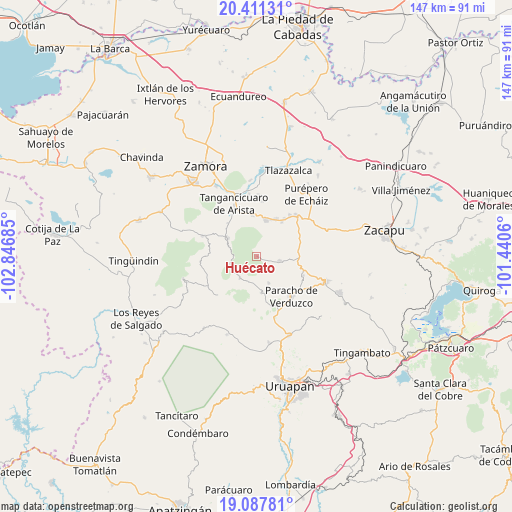
Huécato GPS coordinates[2]
19° 45' 3.348" North, 102° 8' 37.392" West
| Map corner | latitude | longitude |
|---|---|---|
| Upper-left | 20.41131°, | -102.84685° |
| Center: | 19.75093°, | -102.14372° |
| Lower-right: | 19.08781°, | -101.4406° |
| Map W x H: | 147.2×147.2 km | = 91.5×91.5mi |
| max Lat: | 32.7° ⇑48.5% North |
| Huécato: | 19.75093° |
| min Lat: | ⇓51.5% South 14.53588° |
| min Long | Huécato | max Long |
| -117.105° | -102.14372° | -86.73105° |
| W 18.2%⇐ | ⇒81.8% E |
Elevation
Elevation of Huécato is 2262 m = 7421 ft, and this is 1008.3 m = 3308 ft above average elevation for this country.
| Max E: |
3497 m = 11473 ft | 14.9% |
| Huécato | 2262 m 7421 ft | |
| Avg. | 1253.7 m = 4113 ft | |
Min E: |
-1 m = -3 ft | 85.1% |
See also: Mexico elevation on elevation.city.
Geographical zone
Huécato is located in North Torrid zone (between Equator and Tropic of Cancer). Distance of this Northern Tropic circle is 409.8 km =254.6 mi to North.| Distance of | km | miles | from Huécato |
|---|---|---|---|
| North Pole | 7811 | 4853.5 | to North |
| Arctic Circle | 5205.1 | 3234.3 | to North |
| Tropic Cancer | 409.8 | 254.6 | to North |
| Equator | 2196.1 | 1364.6 | to South |


Nearby cities:
15 places around Huécato: (largest is in red/bold)
• Acachuén
12 km =7.5 mi,  26°
26°
• Ahuirán
12 km =7.5 mi,  142°
142°
• Chilchota
11 km =6.8 mi,  14°
14°
• Cocucho
7.9 km =4.9 mi,  217°
217°
• Huancito
13.5 km =8.4 mi,  36°
36°
• Los Nogales
11.9 km =7.4 mi,  353°
353°
• Nurío
10.6 km =6.6 mi,  171°
171°
• Ocumicho
9.6 km =6 mi,  301°
301°
• San José de Gracia (San José Ocumicho)
11.8 km =7.3 mi,  312°
312°
• Santa María Urapicho
8.4 km =5.2 mi,  156°
156°
• Santo Tomás
12.1 km =7.5 mi, 30°
• Tanaco
6.6 km =4.1 mi,  101°
101°
• Tanaquillo
11.6 km =7.2 mi,  24°
24°
• Urén
11.3 km =7 mi, 20°
• Zopoco
12.3 km =7.6 mi, 35°
Sources, notices
• [Note1] Compared only with cities in Mexico existing in our database
• [Src1] Map data: © OpenStreetMap contributors (CC-BY-SA)
• [Src2] Other city data from geonames.org with taken over terms of usage.
• [Src3] Geographical zone / Annual Mean Temperature by Robert A. Rohde @ Wikipedia
